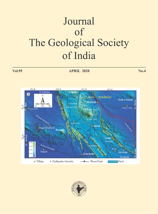
Ground Fracturing Related to 7.8Mw Saravan Earthquake, Sistan and Baluchistan, Iran - Evidence for Brittle Deformation
DOI:
https://doi.org/10.1007/s12594-020-1441-0Keywords:
No Keywords.Abstract
The eastern parts of the Sistan and Baluchistan province, southeast Iran is a tectono-magmatically active zone that continues to witness numerous small and large earthquakes. The volcanism in this region is related to the subduction of the Oman plate below the Eurasian plate. The study of the spatial distribution of the epicenter and focus of the earthquakes suggests close association with the numerous faults related to collisional tectonics. Evidence of ground fractures and faulting related to Saravan earthquake of 16th April 2013 which is the largest (7.8 Mw) recorded earthquake in the region is documented. This earthquake occurred along a segment of the NW-SE trending Saravan normal fault and its reverberations were felt as far away as New Delhi and Dubai. En echelon, 2-km long, northwest-southeast trending surface fractures and faults are recorded in the field near Hampani village southwest of Gosht city. The epicenter is located in the remote hilly terrain east of Gosht. Many of the fractures are listric. The fault records a downthrow of about half a meter and some segments record brecciation of phyllite, liquefaction of sediments and emergence of saline springs are associated features. Despite the high magnitude only a few casualties and minor damage to civil structures were recorded in Iran due to the sparse population and its remoteness.Downloads
Metrics
Issue
Section
Downloads
Published
How to Cite
References
Adeli, H. (1982) The Sirch (Kerman, Iran) earthquake of 28thJuly, 1981: A field investigation. Bull. Seismol. Soc. Amer., v.72, pp.841-861.
Arthurton, R.S., Farah, A., Wahiduddin, A. (1982) The Late CretaceousCenozoic history of western Baluchistan Pakistan the northern margin of the Makran subduction complex. Jour. Geol. Soc. London, v.10, pp.373-385.
Berberian, F., Muir, I.D., Pankhurst, R.J., Berberian, M. (1982) Late Cretaceous and early Miocene Andean-type plutonic activity in northern Makran and central Iran. Jour. Geol. Soc. London, v.139, pp.605-614.
Berberian, M. and Papastamatiou, D. (1978) Kurgu (north Bandar Abbas, Iran), earthquake of March 21, 1977; a preliminary field report and a seismotectonic discussion. Bull. Seismol. Soc. Amer., v.68(2), pp.411-428.
Chiu, H.Y., Chang, S.L., Zarrinkoub, M.H., Mohammadi, S.S., Khatib, M.M., Iizuka, Y. (2013) Zircon U-Pb age constraints from Iran on the magmatic evolution related to Neotethyan subduction and Zagros orogeny. Lithos, v.162-163, pp.70-87.
Farhoudi, G. and Karig, D.E. (1977) Makran of Iran and Pakistan as an active arc system. Geology, v.5, pp.664-668.
Fournier, M., Jentzer M., Karimi H.R., Omran, J., Agard, P., Bonnet G., Whitechurch, H. (2018) Stress patterns along strike-slip faults in Sistan and Baluchestan. Geophys. Res. Abstracts, v.20, EGU2018-18223.
Ghalamghash, J., Schmitt, A.K., Shiaian, K., Jamal, R., Chung, S.L. (2019) Magma origins and geodynamic implications for the MakranChagai arc from geochronology and geochemistry of Bazman volcano, Southeastern Iran. Jour Asian Earth Sci., v.171, pp.289-304.
Jami, M., Solgi, A., Pourkermani, M., Farimani, A.A.M. (2015) Active tectonic signs of Taftan Mountain (South Eastern of Iran). Open Jour. Geol., v.5, pp.637-648.
Kopp, C., Fruehn, J., Flueh, E.R., Reichert, C., Kukowski, N., Bialas, J., Klaeschen, D. (2000) Structure of the Makran subduction zone from wide angle and reflection seismic data. Tectonophysics, v.329, pp. 171-191.
Manafpour, A.R., (2004) Halcrow Group Limited. https://www.istructe.org/sdownloads/resources-centre/technical-topic-area/eefit/non-eefit-reports/bam-earthquake-iran-by-ali-manafpour.pdf
Mohajer Ashjai, A. and Nowroozi A.A. (1979) The Tabas Earthquake of September 16, 1978 in east central Iran: A preliminary field report. Geophys. Res. Lett., v.6(9), pp.689-692.
Nowroozi, A.A. (1976) Seismotectonic provinces of Iran. Bull. Seism. Soc. Amer., v.66, pp.1249-1276.
Nowroozi, A.A. (1985) Fault movements and tectonics of eastern Iran: boundaries of the Lut plate. Geophys. Jour. Royal Astr. Soc., pp. 215237.
Nowroozi, A.A. and Mohajer-Ashjai, A. (1985) Fault movements and tectonics of eastern Iran: Boundaries of the Lut plate. Geophys. Jour. Royal Astro. Soc., v.83(1), pp.215-237.
Platt, J.P., Leggett, J.K., Alam, S. (1988) Slip vectors and fault mechanics in the Makran accretionary wedge, southwest Pakistan. Jour. Geophys. Res., v.93, pp.7955-7973.
Rahnamarad, J. and Nemati, M. (2014) An investigation of 2013 Saravan Earthquake, Sistan and Baluchestan Province, Southeastern Iran. Geodynamics Research International Bull., v.2(4), pp.63-78.
Regard, V., Hatzfeld, D., Molinaro, M., Aubourg, C., Bayer, R., Bellier, O., Yaminifard, F., Peyret, M., and Abbassi, M. (2010) The transition between Makran subduction and the Zagros collision: Recent advances in its structure and active deformation: Geol. Soc. Lond. Spl. Publ., v.330, pp.41-64.
Sadeghi, P. and Khatib, M.M. (2014) Calculation of intensity and ground motion parameters of Earthquakes around Taftan volcano. Bulletin of Environment, Pharmacology and Life Sciences Bull. Env. Pharmacol. Life Sci., v.3(3), pp.201-208
Sepahi, Mohammad Noor (2020) Hazard Risk Assessment of the TaftanBazman Volcanic area, Baluchestan, Iran-a RS & GIS approach. Unpubl. Ph.D Thesis, Savitribai Phule Pune University, Pune.
Stein, R.S. (2019) Triumphs, conundrums, and debates in earthquakes forecasting and seismichazards. Tremblor. http://doi.org/10.3258/ temblor.062
Vahdati, A.S., Gholipour, C., Talebian, M.T., Vahdati, S.S., Mahmoudieh, T. (2014) Disaster in South-East of Iran: Saravan Earthquake with Minimum Mortality. Jour. Academic Emergency Medicine, v.13, pp.216-2018.
Wang, R., Xia, Y., Grosser, H., Wetzel, H.U., Kaufmann, H., Zschau, J. (2004) The 2003 Bam (SE Iran) earthquake: precise source parameters from satellite radar interferometry. Geophys. Jour. Internat., v.159(3), pp.917-922.
White, R.S. (1982) Deformation of the Makran accretionary sediment prism in the Gulf of Oman (north-west Indian Ocean). Geol. Soc. London Spec. Publ., v.10, pp.357-372.
Zare, M., Ansari, A., Heydar, H., Daneshdust, M., Mahdian, M., Sinaiean, F., Farzanegan, E., Alavijeh, M.H. (2013) A Reconnaissance Report on two Iran, Makran Earthquakes; 16 April 2013, Mw7.8, Gosht (Saravan) and 11 May 2013 Irar (Goharan), Bashagard, SE of Iran. Earthquake Engineering Research Institute.
Zoohorian, A.A., Kabiri, A., Ghamsari. M. (1985) Distribution of damages and aftershock activities of two major 1979 earthquakes in east of Kerman, Iran. Jour. Earth Space Sci., submitted to Tehran University Press (in Farsi).

 Mohammad Noor Sepahi


