
SP-10: Water Resources of Kerala: Status and Management
2018 Post Flood Groundwater Scenario of Kerala: A Critical Analysis
SKU:
C-165445
In August 2018, the state of Kerala witnessed a deluge, which affected millions of people and caused 480 or more casualties, similar to that of 1924. In 1924, the amount of rainfall was received in four months was similar to that in 2018, but in the latter it was received in around just two and a half months. IMD data shows that for the entire Kerala the depth of rainfall realised during 15-17, August 2018 is 414 mm, while the same during 16-18, July 1924 was 443 mm. A combination of extreme rainfall events, unprecedented rainfall in the catchment of reservoirs/dams combined with high tide in the Lakshadweep sea made such deluge unavoidable. This paper examines whether this deadly deluge made any significant changes in groundwater scenario of the state. The groundwater levels monitored by CGWB during the end of August 2018 in the State, shows that the water level varies from less than a meter to 20 m bgl (below ground level). Shallow water level was noticed in the coastal and alluvial region in the range of 0.1?2 mbgl. In the midland and high land regions the water level range from 2 to 15 mbgl. Water level of more than 20 m bgl (upto 50 m) was recorded in Pulluvila and Melvettur (Varkala) area in Thiruvananthapuram district. Annual water level fluctuation was calculated by comparing the water level data of August 2018 with August 2017. Comparison indicates a fall in water level in majority of the dug wells representing 57.88% of the total wells monitored. Rise in water level accounted only for 41.45% and only few wells show no change in water level. The data indicates that groundwater level has not picked up considerably during the heavy rainfall. Even the worst flood affected districts, Idukki, Pathanamthitta, Ernakulam and Alleppey, did not show considerable rise in groundwater levels. The groundwater recharge has not improved despite the extreme rainfall in a short span of time. This study shows that 95% of the rainwater goes as surface runoff during heavy rainfall. This is one of the major concerns for the state. However, during November 2018, 81% of the dug wells showed rise in water level and only 19% wells showed fall in trend. This means that groundwater recharge takes place more in the normal rainfall during SW and NE monsoon than in the heavy spells.
Acceleration of Hydrological Cycle: Evidences from the River Basins of Kerala
SKU:
C-165451
The global hydrological cycle is likely to be accelerated due to climate change leading to increase in number of extreme rainfall events and increased evaporation. The potential consequences of anthropogenic climate change in water resources have been widely investigated over the last three decades and numerous studies suggest that climate warming is likely leading to the alteration and intensification of the hydrologic cycle. This is particularly true in the case of the river basins of southern Western Ghats which are fed essentially by precipitation. The problem is more intense in the river basins draining through the densely urbanized areas like that of Kerala. The present study aims to decode the changes in hydro-climatological variables, trace any evidences of acceleration of hydrological cycle and its impact on the hydrological regime of important river basins of Kerala. The study focused on analyzing the changes in the hydro-meteorological variables of the important river basins of Kerala State, located in the western side of the Southern Western Ghats. The study showed evidences of changes in the rainfall distribution between the south-west and north-east monsoon seasons. In general, a declining trend in rainfall is observed during the months of June, July, August and October; and a relatively increasing trend in the month of September and November. The same pattern was observed in the discharges of the studied rivers. Increase in the number of low and no flow events are observed in all the studied rivers. Increase in water lost due to evapotranspiration was noticed in major parts of Kerala during the last decade which indicates the combined effect of increase in temperature and land use changes. Groundwater level showed a decline in the southern and northern edges of Kerala. The changes in hydrological variables during the last two decades showed evidence of acceleration of hydrological cycle, with short and quick rainfall events, increase of flood events and faster loss of water due to evapotranspiration.

Freshwater Sources of Kerala ? Hydrometeorological Scenarios, Environmental Threats and Management Strategies
SKU:
C-165441
Kerala, the southwestern coastal state of India receives an annual average rainfall of about 3000 mm. However, providing uninterrupted freshwater supply to the community round the year is a major challenge to the water managers in the state because of several factors including high population density, increased human interventions in the river catchments, environmental effects due to climate change, etc. It has now become more and more evident that the nature and contributions of rainfall, especially its pattern, have been changing drastically over the years, aggravating the incidences of floods and landslides in the wet season and water scarcity in the summer months. Although such incidences were minimal in the pre-liberalization period (1956-1990), their recurrence and impacts are getting aggravated in the post-liberalization period - a period that witnessed severe environmental degradation due to rapid urbanization and economic development in the region. As per the records of the gauging stations, the number of no-flow/low flow days are found to be increasing even in the lowland reaches of the major rivers in the state. The adverse impact of unabated groundwater ion/pumping is on the rise in many parts of the state, as the activity is being carried out without due regard to the safe yield and natural recharge capability of the aquifer systems. The rapidly changing water scenario of the state in the pre-and post-liberalization periods needs a thorough investigation, especially in regard to the structure and functions of its near surface terrestrial environment called the Critical Zone. The Critical Zone, the zone extending from tree top to the aquifer bottom, of the state is under immense stress due to many of the aforesaid reasons. The stress in the Critical Zone will have a direct effect on the quality, quantity and availability of the freshwater resources in the surface and subsurface reservoirs, which needs to be addressed adequately for laying down strategies for the conservation and management of the freshwater sources.
Ground Water Resources of Kerala: Prospects and Development Strategies
SKU:
C-165440
As per 2011 census, about 62% of the population of Kerala depend on ground water from dug wells and bore wells/ tube wells as drinking water source. Majority of these dug wells gets dried -up during the summer months, causing seasonal water scarcity which affects public water supply. The increasing demand of water year after year has also resulted in pressure on the aquifer systems in the state. Hence, estimation of ground water resource is an important exercise towards the scientific management. Judicious and planned development of ground water has become necessary to ensure its long-term sustainability. This requires scientific estimation of the availability of this resource and the current status of its utilization. In practice, it is periodically assessed and refined based on the approved methodology and as per the updated data inputs. The National Water Policy (NWP) of Government of India also insists periodical assessment of the ground water resources on a scientific basis taking into consideration all the components related to development and management of the ground water resources in any given terrain/area. In this paper, the summary of ground water resources of Kerala, estimated jointly by Central Ground Water Board (CGWB) and State Ground Water Department (SGWD) as on 2009, 2011, 2013, 2017 is presented and a comparison of the changed scenario during these estimates are discussed. All possible criteria have been considered to assess various components of the ground water resources as realistically as possible based on the data available and the data provided by various agencies. As per the computations, there is a steady increase the number of semi-critical blocks during the period from 2009 to 2017. Correspondingly, the number of safe blocks is decreasing during the same period. Further, the area irrigated from ground water sources has shown a whopping increase from 2012 hectares during 1960-61 to 122478 hectares during 2016-17 which shows remarkable dependence of ground water for irrigation. The net annual ground water availability is steadily decreasing during the last decade and the stage of ground water development/extraction has touched to 50 percent as per the 2017 estimates. The exercise of ground water resource estimation is expected to provide an insight to proceed further in developing this natural resource on a sound scientific background in the state. Water managers and planners need to look widely for the optimal ways to improve water management and water supplies for sustainability.
Impact of 2018 Deluge ? Need to Evolve Kerala Water Resources Information System for Long Term Mitigation
SKU:
C-165454
Kerala had undergone a devastating flood in August 2018. The extreme rainfall and the very high population density of 860 persons per square kilometer, made the deluge significantly affecting a population of 1.2 million. About 400 persons lost their lives and the basic infrastructure facilities were seriously damaged. The state of Kerala is now on a massive mobilization drive to rebuild a new Kerala. RKI (Rebuild Kerala Initiative) focus on sustainability principles suggested in the Post Disaster Needs Assessment (PDNA) study. Integrated water resources management (IWRM) has been identified in the PDNA as one of the four pillars of recovery strategy. Draft sector plan for water resources management which fits within an IWRM framework is now being actively deliberated in Kerala at various levels. One of the most important aspects discussed in the sector plan is improving the data and knowledge management systems, including reliable monitoring systems (water level, water quality, water use) with adequate spatial and temporal coverage. Kerala Water Resource Information System (KWRIS) as it has been christened aims to address all the data related issues pertaining to the development of strategic water sector plans. In this paper, the key elements of KWRIS for sustainable water management are discussed. Four sections build this paper. In the introduction section, the 2018 deluge and the background in which the need for KWRIS is evolved are discussed. This is followed by the detailed discussion of KWRIS framework in the second section. Third section discusses the challenges and opportunities in shaping up KWRIS in the current Kerala context. Thoughts on way forward and the immediate interventions required to facilitate this are discussed in the concluding section.
Is the Water Future of Kerala Fuzzy?
SKU:
C-165456
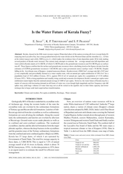
Kerala, classed in the fifth water resource region (Watershed atlas) of the nation covering all rivers (except Indus R) emptying into Laccadive Sea, has a steep gradient between the water divide on the Western Ghats and the shoreline (i.e., 125 km at the widest transect and a lofty 3000 m a.m.s.l.), which makes the residence time of rain deposition under 48 hr truly making several pockets of Kerala water stressed. The current study attempts to estimate the average annual rain fall deposition and water yield in Kerala stands at 41.6 BCM, of which 5.2 BCM adds to the groundwater resources and 36.4 BCM goes as surface run off. These figures confirm that the surface and groundwater resources show a declining trend as the figures deviate from the estimates of CGWB (groundwater resources= 5.66 BCM) and a state government source (surface water =78 BCM). Despite falling in the Am climate zone of Koppen - tropical monsoon climate - Kerala (extent =38863 km2; average rain fall =3107 mm/y) was empirically and proverbially deemed as a water surplus state, with an annual per capita entitlement of 1991.0 m3 for a population load of 34.8 million (Census, 2011), against 4921.0 m3 of annual per capita for a population of 13.54 million (Census,1951). With a rising population and steadily rising social and economic development, Kerala?s annual per capita water entitlement stands higher than the national annual average of 1600 m3 per capita. However, the water future of Kerala may be a matter of concern with increasing demand on all fronts of water use, even though high magnitude and low frequency rain fall spikes may yield huge volumes of water that may not at all be stored in the aquifers due to their finite capacity and lower recharge due to large scale land scape/surface transformation.
Major Element Chemistry of the Bhavani River, Kerala, SW India ? Weathering Processes and Solute Transport
SKU:
C-165446
Rivers are the natural pathway of geochemical signals from terrestrial environment to the ocean realm. This life sustaining system is more reflexive to the adversities of urbanization, industrialization and other human interventions. The problem is severe in small tropical rivers of the southern Western Ghats. Although many studies have been carried out in the west flowing rivers of the Kerala, not much attempt has hither to been made on the east flowing rivers of the state. Therefore, an attempt has been made in this paper to address the major ion chemistry and solute transport of Bhavani river of Kerala which is east flowing and a tributary of the Cauvery river. Hydrochemical data of the Bhavani river, its different stretches, was obtained from field work, sampling, in-situ and laboratory analysis. In order to understand the spatio-temporal changes in the river water chemistry and causal mechanisms behind the changes in the long-term discharge characteristics, data from three gauging stations (Nellithurai, Thengumarahada and Savandpur) have been obtained from the Central Water Commission (CWC) via the surface water module of the India - WRIS (Water Resources Information System). The eastern part of the river basin experiences semiarid/ arid climate with rainfall predominated by the northeast monsoon, but the western most part of the river basin experiences humid climate with dominant southwest monsoon. The controlling factor of the major ion chemistry of the river water was characterised using Gibbs?s Diagram and it indicates that the chemistry of the river water is controlled mainly by silicate weathering in the river catchments rather than rainfall contributions. The river water chemistry of Bhavani river is dominated by Ca, Na and HCO3. The hydrochemical analysis shows that majority of the water samples are of Ca-HCO3 type. The particulate load/dissolved load ratio of the Bhavani river is much less than that of the west flowing rivers of Kerala indicating the dominance of chemical weathering and evaporation, over physical weathering. An overall evaluation of the major ions in the Bhavani river revealed that its availability in river water is contributed by both natural and man-made factors.
Plausible Offshore Freshwater Aquifer System off the Kerala Coast: A Case Study from the Kuttanad Area of Kerala
SKU:
C-165443
Offshore freshwater aquifer systems exist in many parts of the globe as seaward extension of coastal aquifers. The coastal aquifer systems are often very heterogeneous, combining numerous high permeability aquifers interlaid with low permeability aquitards with varying total thickness.This heterogeneity plays a major role in the fresh groundwater storage, movement, and groundwater salinity distribution within such systems. The Kuttanad is a low lying coastal tract in the western coast of Kerala underlain mainly by the Recent alluvium and thick Tertiary sediments unconformably resting over the Archaeancrystallines.The isopach maps of stratigraphic formations indicate offshore extension of the aquifer systems. The hydraulic gradient and its response to groundwater draft over the decade in these confined aquifers indicate offshore freshwaterseawater interface.The marine transgressions and regressions in the Pleistocene period influenced the evolutionary history of groundwater in the aquifer systems in this sedimentary formation. Offshore groundwater resources could act as an important additional freshwater resource in times of rising water stress.
Precepts for Groundwater Drought Index in Kerala: A Case Study from Chaliyar River Basin
SKU:
C-165452
Groundwater Drought Index (GWDI) is recognized as one of the key Hydrological Indices of drought. But the evolution of drought from meteorological to hydrologic drought is not instantaneous and is dominated by several physical mechanisms. In Kerala due to heterogeneity of terrain, the occurrences of drought at different temporal and spatial scales do not fit into the broad indices of standard GWDI. Hence drought prediction has become a major challenge to decision and policy makers as it fails to address multiple causative factors to recognize the actual ground realities. This paper is an effort to bring out the meteorological, hydrogeological and hydrological factors based on which an attempt has been made to review the groundwater drought index to suggest an improved groundwater deficit class by studying the extreme climate eventualities during 2016 (drought) and 2018 (flood). The progression of drought and its corresponding effect on groundwater regime in Chaliyar river basin has been studied in detail. Based on the typical response of drought conditions in different physiographic zones, a modified GWDI from the case study is proposed.
Predictive Modeling and Groundwater Impact Assessment for a Highway Engineering Project in Vizhinjam, Kerala
SKU:
C-165453
Groundwater Impact Assessment is an evaluation of foreseeable impacts on groundwater system, both beneficial and adverse. It is intended to help reveal mitigating measures and alternative solutions to optimize positive impacts while reducing or limiting negative impacts. In highway construction projects a consistent transportation network, through environmentally balanced development is possible only through a detailed knowledge of geology, natural resources and analysis of the land use pattern with precise database. The derogation of water sources for the creation of barriers and pathways for groundwater flow formed by foundations or ground improvement processes for highway construction in a sub watershed of Karamana river basin near Vizhinjam International Sea port area is envisaged in the present study. The study is addressed to generate a database for planning and design process based on the societal concern related to the groundwater impact of post road construction scenario. The modeling for the management of urban hydrology is based on the surface runoff, the rate of rainfall, aquifer characteristics, hydro-geological and geotechnical observations, the type of receiving environment and the applicable criteria for the receiving water course. The spatial analysis of the data generated through field survey, shows draining nature of shallow groundwater zones as indicated by 81 non-perennial wells and farm ponds within the watershed. Geotechnical and geophysical survey shows the presence of a major stratum of laterite with clayey soil at the top and weathered rock at places at the bottom in the core sections. Modeling of the groundwater flow of the region through MODFLOW shows a lesser recharge and a lesser vertical flow compared to evapotranspiration and the hydraulic conductivity respectively. Thus an action plan is proposed to be developed for the construction of link road by reviewing the existing practice of water resource utilization and also by assessing the environmental impact to the groundwater regime to improve the existing groundwater availability of region by constructing subsurface dykes, recharge ponds, elevated road above the existing ponds etc. The study was thus aimed to suggest remedial measures to nullify the impact on the groundwater ecosystem, and also to improve the present status of groundwater availability through predictive modeling.
Role of Submarine Groundwater Discharge in Coastal Aquifer Management
SKU:
C-165450
Submarine groundwater discharge (SGD) reportedly influences the global coastal environment significantly and Indian coast is not an exception. There are strong evidences to the fact that many land derived contaminants like carbon, nutrients, organics, metals and pathogens affect chemical and biological processes of near shore region, wherever SGD occurs. Further, the intensity of mixing and exchange increases depending on the residence time available during recirculation of SGD. Thermal infrared images allow us to monitor physico-chemical changes in land-ocean interface as well as to spatially map the submarine groundwater discharges, particularly through unconfined aquifers. This study attempts to identify and compute the total volume of SGD across selected sites in SW coast and also investigate the intensity of mixing using different parameters like temperature, salinity and radon in groundwater and pore water. There are reports that salinity reduction and excess nutrients induce eutrophication, mudbanks and algal blooms. On quantification of freshwater discharges in such anomalous zones, optimum pumping of groundwater from respective coastal aquifer layers can be advocated. Also release of nutrients and other pollutants through freshwater discharge can be monitored using sensor-based permanent piezometers, as management options.
Scope of Groundwater Conservation in Kerala: Case Studies and Policy
SKU:
C-165449
The State of Kerala receives an average annual rainfall of about 3000 mm and has forty-four rivers in addition to many surface water bodies. Though the overall groundwater resource situation in the State is not causing any serious concern at present, there are areas where water scarcity is being felt, especially during summer months, due to a combination of topographic, geologic, hydrogeological and anthropogenic factors. The monsoon recharge in phreatic aquifers is low due to the limited thickness of aquifers which is about 7 m on an average and water level fluctuation of less than 4m in 80% of the area. Because of this low storage space, the stored water gets exhausted or greatly reduced whenever there is a delay in the onset of monsoon. The State experiences hydrological drought frequently as a consequence of this feature. Moreover, in the midlands and high lands, characterized by undulating topography and high gradients, the base flow is relatively high. The study pertains to an evaluation of the scope of groundwater conservation in various aquifer systems and the efficacy of groundwater conservation practices and policies in the State given the above issues.
Status of Surface Water Resources of Kerala ? Development and Management Issues, Future Strategies
SKU:
C-165439
Kerala State is a narrow strip of land situated on the south-west coast of India with the Western Ghats as its eastern boundary. The State experiences a humid tropical climate and receives an average annual rainfall of 3000 mm, which feeds all the water bodies in the State. Rising population, urbanization, industrialization, changing life style of people, etc. is increasing the freshwater demand in Kerala every year. Water management in Kerala is a difficult task due to high spatial and temporal rainfall variations, undulating topography with steep slope towards sea, high population density, lengthy coastal stretch with saline backwaters and estuaries, climate change, etc. The State faces recurring floods and droughts, pollution in freshwater bodies, salinity intrusion/ingress in rivers and coastal aquifers, etc. In the context of spatial and temporal variations in water availability, increasing water pollution and the steady increase in water demand over the years, the State should have scientific water conservation and management strategies aimed at the improvement of surface water and groundwater availability, mitigation of flooding during monsoon, prevention of water pollution and improvement of the water quality, improvement of water use efficiency, prevention of unscientific land use changes, creation of water awareness, rainwater harvesting and also the wise and efficient use of freshwater resources, etc. Status of surface water resources of Kerala, its development and management issues and future management strategies are presented here.
Surface Water Resources of Kerala: Key Policy Issues and Management Strategies
SKU:
C-165448
Though the tiny state of Kerala in South India appears to be extraordinarily rich in water resources, there are several challenges associated with its sustainable management. Recent occurrences of extreme climatic events in the form of heavy rainfall over noticeably short periods, signify the urgent need for Integrated Water Resource Management (IWRM) in the state. Revisiting the state water policy in this context needs wider consultations and more meaningful deliberations. Along with a broad overview of the surface water potential of the state, this paper discusses some of the important concerns that are to be addressed with adequate policy responses. Pollution abatement, ensuring adequate environmental flows in the river basins, having the Water Resources Information System (WRIS) in place, revisiting its interstate water sharing pacts, grooming the real time integrated operation of its reservoirs, and rolling out conjunctive water management plans are all vital. Equally vital are the plans to improve water conservation, propagating community micro irrigation systems and adopting climate resilient cropping. Setting up the appropriate institutional arrangements and enabling the environment for IWRM must be crucial for the state in this perspective.
Vattatha Uravakkay Jalasamrudhi ? A Model Initiative on Water Conservation
SKU:
C-165455
?Vattatha Uravakkay Jalasamruddhi? is a model water conservation project taken up in Kattakada Legislative Assembly constituency suffering from water scarcity despite presence of two main rivers, numerous streams, canals and ponds. KSLUB was entrusted with preparing a technically and economically viable integrated water management plan. A comprehensive data base was prepared on existing water resources and their problems through primary data collection aided by Satellite Images scanning and GIS. Trainings were conducted to the volunteers at Block and Gram Panchayat Levels for baseline data collection. A volunteer force (Jalamithras) in each ward was selected. Mass awareness programs were organised. The problems were identified as drying wells, poor water quaity, shrinking wetlands and deteriorating surface water sources. The water conservation programs included planting of seedlings, digging rainwater pits, rejuvenation of ponds and streams, artificial recharging of wells, increase in inland fisheries etc. Within a year of launching the project a perceptible outcome was rise in water levels of wells, which became perennial. This is a replicable model for water conservation through active participation of people, effective planning and convergence of activities of stakeholders and line departments.
Water Quality of the Phreatic Aquifer System in Kerala
SKU:
C-165447
Quality of groundwater has not been a major constraint in the State of Kerala due to the frequent flushing of the phreatic aquifers by the prolific monsoon rains. However, there is considerable spatial variation in the concentrations of all the chemical constituents in the aquifers, caused by a host of factors including soil type, land use, geology, geomorphic set up and human activities. The hydrochemical characteristics of groundwater in different rock formations in Kerala have been interpreted from the analytical results of 505 groundwater samples collected from the phreatic aquifers. The hydrochemical characteristics, of the phreatic aquifers in River Alluvium, Coastal Alluvium, Laterites and Crystalline Rocks have been evaluated. Microbial contamination of freshwater is prevalent in the State due to shallow water conditions, high population density and associated sanitation issues. Fluoride and iron are two geogenic contaminants in the State, though mostly within negligible concentrations. The water quality and pollution by the inorganic constituents in groundwater are mainly discussed in this paper.
Water Resources Development and Conservation in Lakshadweep Islands, India
SKU:
C-165444
Groundwater is the major source of domestic water in most of the inhabited islands of the Union Territory of Lakshadweep. Groundwater occurs as thin freshwater lens floating over saline water. There is remarkable temporal variation in the thickness and areal extent of the freshwater lens, depending on contributory factors of which the mode of groundwater draft, diurnal tidal fluctuation, and the intensity & distribution of rainfall are of significance. In some of the very small islands, the freshwater lens is almost absent except during the rainy season. The islands are made of highly porous coral sand as topsoil, forming the aquifer material, resulting in almost entire rainfall on the ground percolating down, with negligible surface runoff even during intense rainfall. Thus there is not much scope for traditional artificial recharge into groundwater. Instead, direct harvesting of rainwater and conservation will reduce the stress on the fresh groundwater lens. The paper discusses the groundwater occurrence, resource availability in each of these Islands, its development prospects, and viable water conservation methods for freshwater sustainability.