Publications
Rejuvenation of Kerala Rivers: Geoenvironmental Setting, Potentials, Problems and Recent Initiatives
SKU:
C-62865
Kerala State can be broadly divided into three well definable zones, with high mountains of Western Ghats extending NW-SE in the east (Precambrian), a long narrow coastal plain in the west (Recent), flanked by Arabian Sea, and an undulating terrain (Precambrian and Tertiary) in between. Laterite in different forms is a ubiquitous rock in most of the places. River restoration has drawn considerable attention across the world as river systems are variously affected due to human intervention and in many cases irreversible changes have taken place. Due to high population density, with intense use of land and indiscriminate resource extraction, rivers in Kerala are under stress as has been reported in various studies. Restoration plan warrants proper understanding of the river system. This paper discusses various geo-environmental issues that impact the river system. Physical characteristics of the rivers have been deliberated and problems are identified. It is suggested that restoration of rivers warrants catchment scale approach considering all parameters, local initiatives like river bank mapping and involvement of all stake holders.
Relevance of Geospatial Technology in River Rejuvenation
SKU:
C-156156
Geospatial Science and Technology have seen tremendous growth globally, especially in the natural resources development and management. National programs like National Natural Resources Management Systems (NNRMS) and National Resources Information Systems (NRIS) of the Department of Space, NDRMS of DST and GISNIC of National Informatics Centre (NIC) have demonstrated the utility of Geospatial technologies to its stakeholders mainly to the planners and the decision makers to a larger extent. As a result, huge demands have been generated for this technology, which has made in roads across various sectors in the public as well as private domain in India. Out of many natural resources, water is one such sector where this technology has played a vital role. The Art of Living has taken a similar approach in mapping the surface and groundwater resources at micro watershed/ village level wherein the village community itself is carrying out the implementation of the same at the field level. While preparing the management action plan of water resources and land resources satellite images of IRS and Landsat data are used . The data from Bhuvan and WRIS-India are also taken as baseline data while the same are being brought to the cadastral level for the easy understanding and implementation by the field officials of the government sector and the volunteers of the Art of Living. Micro watershed development requires delineation, characterization, prioritization, generation of development plans, monitoring the implementation and the impact assessment. All the stages of the work involves the remote sensing techniques and GIS. Starting from the action plan creation, rainfall data analysis and training the ground volunteers for using the data created through platforms like google my maps and collector survey app, Geospatial technology is used extensively. This paper aims at discussing the relevance of geospatial technology in this work.

Revisiting East Kolkata Wetlands ? Management Options with Holistic Approach
SKU:
C-165852
East Kolkata Wetlands (EKW) are series of shallow depth sewage-fed fisheries thriving in eastern part of Kolkata City. These water bodies, erstwhile part of Sundarbans, represent the spill basin of once mighty river ?Bidyadhari?. These were originally saline in nature, which gave rise to its name as ?Salt Lake?. Traditionally ?Capture Fishing? was practiced here. Sudden changes in course of the Ganges towards east due to neo-tectonic movement transformed the spill basin into stagnant water bodies. Some portion of this area was leased out in 1868 for solid waste dumping, renamed as ?Dhapa?. Subsequently, local fishermen tried to utilise city sewage flowing towards eastern side through canals as source of water and nutrient which became successful in 1929-30. Altogether 7300 hectares of sewage-fed fisheries existed here in 1945. Due to population explosion and urbanisation, indiscriminate reclamation of these wetlands was going on without considering the considerable ecosystem services being provided by them. Subsequently, Calcutta High Court imposed injunction on further reclamation of these wetlands in 1992, which by that time became famous as EKW, even though these wetlands are still under threat. An objective interdisciplinary assessment of various issues of concerns in EKW and suggesting available management option towards its sustainability has been attempted here.
River Rejuvenation Initiatives in Karnataka under Mahatma Gandhi National Rural Employment Guarantee Scheme
SKU:
C-156161
The Vedavathy River Basin was taken up for rejuvenation based on the model of Kumudvathy River Rejuvenation Project implemented by Vyakti Vikas Kendra. The goal of the project was increasing the baseflows of the river Vedavathy through watershed management In its catchment following an approach of community engagement and employment generation under the aegis of MGNREGA. This article gives structured details of implementation of the project.
River Systems and Other Surface Water Bodies of East-Central India: Their Status and Management Needs
SKU:
C-62881
The health of major river systems and other surface water bodies of East-Central India has been discussed. The geological conditions such as lithological variation, their weathering resistance, presence of rift valleys and tectonic trends have decided watershed conditions, which have controlled formation of river systems in East-Central Indian region. The development of Vindhyan Range, Satpura Range, Maikal Hills, Kaimur Hills, Eastern Ghat ranges, Chhotanagpur and Bastar plateaus in East-Central India have given birth to many big rivers e.g., Narmada, Son, Damodar, Mahanadi, Wainganga-Pranhita etc. The presence of major rift zones such as Narmada-Son-Damodar Rift, Mahanadi and Godavari rifts have guided the courses of almost all rivers in the region. The Vindhya-Satpura Ranges and Chhotanagpur Highland have separated the north Indian drainage from south Indian drainage systems. Except for the Himalayan Rivers, which are mostly snow fed, other rivers of India are monsoon fed and become dry during most part of the year causing difficulty to the society. The flow and storage of most rivers are becoming deficient day by day due to extensive siltation.Besides these major rivers, other surface water bodies such as lakes, artificial reservoirs, swamps, wetlands, canals and traditional water harvesting structures are also reducing or becoming defunct due to siltation, pollution, dumping of waste, illegal conversion for other uses and overall neglect by the society. In view of population growth, rapid industrialization and urbanization there would be more pressure on water bodies. Climate change would bring variability in monsoon rainfall which will have its impact on water resource. Unless extreme care is taken to save all the variety of water bodies, there would be severe water crisis in future in the country. A new national water policy is now needed to maintain country's water resource for its sustainability.
River Systems and Water Resources of West Bengal: A Review
SKU:
C-62893
West Bengal (88,752 km2) is the only Indian state that extends from the Himalaya to the Bay of Bengal. It can be divided into nine physiographic provinces of which the Himalayas, the western plateaus, the northern and western alluvial fans and the Ganga delta are the most important. The development of the river system of the state was largely governed by tectonic evolution of the eastern Himalaya and western edges of the Bengal basin. The characteristics of the rivers as well as a number of aspects of water resources of the state can be linked to its physiographic regions. The principal issues associated with water in West Bengal include river degeneration, channel shifting, flood, urban waterlogging, drought, pollution, groundwater depletion and inland navigation. The management of water is practised by river impoundment projects in various scales and by drainage schemes. It is estimated that the western and eastern parts of the state are the most water stressed regions due to climatic and human factors respectively. The solutions for many of the water-related problems of West Bengal, progressive or cyclic, can be achieved by putting emphasis on participatory management besides organisational intervention.
Role of Geotechnology in Groundwater Recharge and River Rejuvenation Works
SKU:
C-156160
Geotechnology has a significant role to play in recharging the groundwater by arresting the surface runoff , thereby, allowing the water to penetrate the ground. This paper highlights the importance of geotechnology in river rejuvenation and discusses geotechnical schemes for ground recharging. The artificial techniques can be used for groundwater recharge, which can be classified as surface methods and sub-surface methods. This paper briefly discusses artificial groundwater recharge techniques and geotechnical considerations associated along with the methods to reduce flow velocity of the surface and subsurface water. Groundwater hydrology, soil/rock characteristics, and permeability are the major factors governing the efficiency of groundwater recharge techniques. Surface methods enhance groundwater infiltration by providing more residence time with the help of structural and nonstructural measures. Subsurface structures enhance the infiltration of water into the aquifer. This paper also discusses the concept of the subsurface dike or underground dams and its applicability in storing a large amount of water underground to ensure base flow in streams. Different materials with significant applications in groundwater recharge through geotechnology are also discussed in brief.
Role of Submarine Groundwater Discharge in Coastal Aquifer Management
SKU:
C-165450
Submarine groundwater discharge (SGD) reportedly influences the global coastal environment significantly and Indian coast is not an exception. There are strong evidences to the fact that many land derived contaminants like carbon, nutrients, organics, metals and pathogens affect chemical and biological processes of near shore region, wherever SGD occurs. Further, the intensity of mixing and exchange increases depending on the residence time available during recirculation of SGD. Thermal infrared images allow us to monitor physico-chemical changes in land-ocean interface as well as to spatially map the submarine groundwater discharges, particularly through unconfined aquifers. This study attempts to identify and compute the total volume of SGD across selected sites in SW coast and also investigate the intensity of mixing using different parameters like temperature, salinity and radon in groundwater and pore water. There are reports that salinity reduction and excess nutrients induce eutrophication, mudbanks and algal blooms. On quantification of freshwater discharges in such anomalous zones, optimum pumping of groundwater from respective coastal aquifer layers can be advocated. Also release of nutrients and other pollutants through freshwater discharge can be monitored using sensor-based permanent piezometers, as management options.

Scope for Conjunctive Use and Interlinking of Rivers in Assam
SKU:
C-165839
Not with standing known contamination of groundwater by inorganic contaminants like arsenic and fluoride, a major proportion of rural communities in Assam relies on groundwater as a source of drinking water. First revealed during 2004, a comprehensive picture of groundwater contamination from arsenic in the Brahmaputra Valley emerged during a collaborative study by IITG-UNICEF and PHED, Assam. The study revealed that in 29% of a total 56,180 public sources analyzed arsenic content is above the threshold value of 10 ppb (WHO/BIS) exposing a huge unguarded population to the risk of arsenic contamination and resultant health hazard. It also brought to light a zone along the southern bank of the Brahmaputra River where arsenic levels were much above the recommended values. Public Health Engineering Department (PHED) of Assam initiated one of the grandiose piped water supply schemes for the state , where surface water from two major tributaries of Brahmaputra, the Dhansiri and the Doiang Rivers, are used for supply of arsenic free safe water to a designed population of 1, 90,000. While adequate surface water availability in the vicinity of such high arsenic contaminated aquifers have provided a viable alternative, this is infeasible in areas with discreet contaminated groundwater with scarce surface water sources nearby. Solutions like integration of rainwater harvesting structures, water recharging, delineation and safeguarding safe aquifers, reuse and recycling, water saving technologies, smart systems and conjunctive use then form part of a composite option necessitated for addressing the gaps and inadequacies in ensuring safe drinking water in the region.
Scope of Groundwater Conservation in Kerala: Case Studies and Policy
SKU:
C-165449
The State of Kerala receives an average annual rainfall of about 3000 mm and has forty-four rivers in addition to many surface water bodies. Though the overall groundwater resource situation in the State is not causing any serious concern at present, there are areas where water scarcity is being felt, especially during summer months, due to a combination of topographic, geologic, hydrogeological and anthropogenic factors. The monsoon recharge in phreatic aquifers is low due to the limited thickness of aquifers which is about 7 m on an average and water level fluctuation of less than 4m in 80% of the area. Because of this low storage space, the stored water gets exhausted or greatly reduced whenever there is a delay in the onset of monsoon. The State experiences hydrological drought frequently as a consequence of this feature. Moreover, in the midlands and high lands, characterized by undulating topography and high gradients, the base flow is relatively high. The study pertains to an evaluation of the scope of groundwater conservation in various aquifer systems and the efficacy of groundwater conservation practices and policies in the State given the above issues.
Sediment Characteristics and Foraminiferal Distribution in the Bet Zone of the Great Rann of Kachchh, Western India
SKU:
C-63299
Based on geomorphological characteristics, the vast, flat saline tract of the Great Rann of Kachchh is considered as a raised floor of a former gulf that was connected to the Arabian Sea in the west. In general, the Rann exhibits a unique supratidal environment complicated by alternating periods of marine and freshwater inundation and extreme dryness. The Great Rann is divisible into four distinct geomorphic domains - the Banni plain, the Linear trench zone, the Great barren zone and the Bet zone. Contrary to the rest of the Great Rann, the Bet zone shows distinct variations in elevation due to the presence of bets (islands) and is dotted by several vegetated elevated areas, seasonal short distance channels and local depressions. The present study attempts to characterize the environmental conditions of the Bet zone comprising the northwestern part of the Great Rann. Surface sediment samples were collected by digging small pits in the Rann surface at several locations along ESE-WNW and roughly N-S oriented transects (transect 1 and 2). The samples were subjected to detailed grain size analysis and micropalaeontological analysis for determining foraminiferal assemblage. Overall, the sediments of the Bet zone are of sandysilty to clayey-silty in nature. The grain size was found to vary in accordance with the microgeomorphic setting of the stations. The foraminiferal assemblages recorded along the two transects belong to twelve genera (Ammonia, Elphidium, Bolivina, Nonian, Bulimina, Cibicides, Helenina, Brizalina, Globigerinella, Globigerina, Globorotaloides Gallitellia). Presence of some reworked foraminiferal tests suggests the transport of foraminifera from the Arabian Sea water surges under the influence of strong SW monsoon winds. However, the relatively higher diversity near the open ocean gets reduced in the Great Rann due to the typical hypersaline conditions, submergence patterns, mixing by fresh water (runoff, fresh water influx), and the microenvironments created by variations in the elevation of the Rann surface. The diversity is limited to the few tolerant taxa which can survive through such large scale changes in the environmental parameters.
Sequence Stratigraphic Analysis of a Shallow Marine, Mixed Carbonate-Siliciclastic System, Early Miocene, Kutch
SKU:
C-105411
The Early Miocene succession in Kutch (western India) is represented by a mixed carbonate-siliciclastic system. A combined sedimentological, trace fossil assemblage and micropaleontological analysis of the succession was carried out to refine sequence stratigraphic architecture. In this mixed carbonate-siliciclastic system, the trace fossil complement the micropaleontological data in the carbonate portion and provide crucial information in the siliciclastic part, particularly in identifying key stratal surfaces. The sedimentary succession records single cycle of third order fluctuation in relative sea-level (~7 Ma.) with higher order fluctuations of million year episodicity. The preserved sequence is asymmetric, consisting of a thick transgressive systems tract (TST) and a relatively thin highstand systems tract (HST). The transgressive systems tract exhibits a gradual change in foraminiferal assemblage indicating deepening upward succession in overall middle shelf environment. The trace fossils change from Psilonichnus ichnogenera to Skolithos assemblage to Thalassinoides assemblage, from the base of the section to the top. The reworked burrow tubes of Psilonichnus ichnogenera concentrated in the lower part of the TST indicates lag concentration, accumulated during onset of the transgression. The recurrence of larger foraminifera and trace fossil attributable to the Thalassinoides assemblage at various stratigraphic levels (i.e. upper part of TST and lower part of HST) marks the higherorder flooding surfaces and base of parasequence. A high abundance of planktonic foraminifera, including Cassigerinella, Globigerina and Globorotalia, characterizes the maximum flooding surface (MFS) corresponding to a maximum bathymetry of ~50m. The progressive shallowing in highstand systems tract exhibit siliciclastic dominated succession with increased coarse clastic sediments towards top and it is marked by a gradual decrease in the abundance of ichnogenera and shallow water foraminifera and their absence in the upper part of the HST.
Sequence Stratigraphic Analysis Of the Mixed Siliciclastic-Carbonate Sediments (Middle Jurassic) Of the Patcham Island, Kachchh, Western India: An Ichnological Approach
SKU:
C-63292
The Middle Jurassic (Bajocian to Callovian) sequence of the Patcham Island, Kachchh, comprises mixed siliciclastic-carbonate sediments displaying transgressive-regressive cycles that record changes in the relative sea level condition. These mixed siliciclastic carbonate sediments are of varying composition representing six sedimentary facies namely, micritic sandstone, allochemic sandstone, sandy allochem limestone, sandy micrite, muddy micrite, and micritic mudrock along with the grey shale, allochemic limestone and ferruginous sandstone facies. These sedimentary facies are bioturbated with a total of 65 ichnospecies of 42 ichnogenera which are recurring throughout the sequence. The trace fossils are further grouped into nine trace fossil assemblages based on environmentally related traces based on diversity, frequency and preservational aspects (viz., Arenicolites, Asterosoma, Gyrochorte, Ophiomorpha, Planolites/Palaeophycus, Phycodes, Rhizocorallium, Skolithos and Thalassinoides assemblages). The sedimentary units (packages) coupled with ichnoassemblages reveal three transgressive system tracts (TST) and four regressive system tracts (RST) separated by flooding surfaces representing 3rd order transgressive-regressive (T-R) cycles bounded by regressive surfaces. In the T-R cycle, presence of the Rhizocorallium ichnoassemblage (TRC-II) and Arenicolites, Thalassinoides with Planolites-Palaeophycus assemblages (TRC-III) mark the flooding surfaces while the Skolithos assemblage with the Planolites-Palaeophycus assemblage (TRC-I), Arenicolites assemblage (TRC-II) and Planolites-Palaeophycus assemblage (TRC-III) mark the regressive surfaces. These soft ground ichnoassemblages mark the Skolithos and Cruziana ichnofacies conditions developed in progradational and retrogradational sequences and indicate cyclic changes in bathymetry within shoreface-offshore settings. An integrated sedimentological and ichnological approach has allowed the recognition of the internal organization of the sequence in absence of significant physical expressions of discontinuity surfaces at the T-R cycle scale.
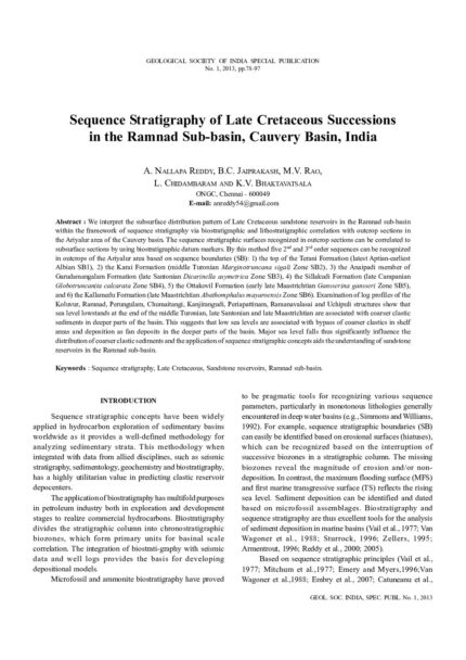
Sequence Stratigraphy Of Late Cretaceous Successions In the Ramnad Sub-Basin, Cauvery Basin, India
SKU:
C-63294
We interpret the subsurface distribution pattern of Late Cretaceous sandstone reservoirs in the Ramnad sub-basin within the framework of sequence stratigraphy via biostratigraphic and lithostratigraphic correlation with outcrop sections in the Ariyalur area of the Cauvery basin. The sequence stratigraphic surfaces recognized in outcrop sections can be correlated to subsurface sections by using biostratigraphic datum markers. By this method five 2nd and 3rd order sequences can be recognized in outcrops of the Ariyalur area based on sequence boundaries (SB): 1) the top of the Terani Formation (latest Aptian-earliest Albian SB1), 2) the Karai Formation (middle Turonian Marginotruncana sigali Zone SB2), 3) the Anaipadi member of Garudamangalam Formation (late Santonian Dicarinella asymetrica Zone SB3), 4) the Sillakudi Formation (late Campanian Globotruncanita calcarata Zone SB4), 5) the Ottakovil Formation (early late Maastrichtian Gansserina gansseri Zone SB5), and 6) the Kallamedu Formation (late Maastrichtian Abathomphalus mayaroensis Zone SB6). Examination of log profiles of the Koluvur, Ramnad, Perungulam, Chumaitangi, Kanjirangudi, Periapattinam, Ramanavalasai and Uchipuli structures show that sea level lowstands at the end of the middle Turonian, late Santonian and late Maastrichtian are associated with coarser clastic sediments in deeper parts of the basin. This suggests that low sea levels are associated with bypass of coarser clastics in shelf areas and deposition as fan deposits in the deeper parts of the basin. Major sea level falls thus significantly influence the distribution of coarser clastic sediments and the application of sequence stratigraphic concepts aids the understanding of sandstone reservoirs in the Ramnad sub-basin.

SkyTEM ? A Highly Efficient Helicopter-Borne TEM System
SKU:
C-95955
A modern helicopter-borne transient electromagnetic ("HTEM") system like SkyTEM can be used for many different applications such as aquifer mapping, mineral exploration, and geotechnical engineering. This broad range of applications necessitates, however, that the technology is versatile and fulfils essential criteria like good near-surface resolution, high signalto-noise ratio, and cost-effective operations. This paper demonstrates how SkyTEM systems are designed to accommodate these technical requirements. Furthermore, examples of utilization of SkyTEM systems for various applications will be shown.

Soil Conservation, Crop Water Planning and its Use Efficiency in Rainfed Agriculture
SKU:
C-95946
Soil and water are the major natural resources endangered with erosion, which need to be conserved for existence of life. Soil and rainfall characteristics in the state is highly diversified, necessitating efficient conservation. In-situ conservation practices can help in low rainfall areas to protect these resources. Ex-situ conservation practices are essential in sustaining agriculture in rainfed ecosystem and safe disposal of excess water is the concern in high rainfall coastal areas. Contour farming, deep tillage once in 2-3 years under crop rotation using tractor drawn implements like Disc Plough, Mould Board Plough and Chisel Plough, inter-terrace management through bunding and vegetative barriers based on the rainfall intensity, slope and texture of the soil, broad bed furrows in black soil, moisture conservation furrows/dead furrows, mulching with crop residue/ weeds, community based water harvesting structures, scooping can help for conservation of soil and water resources. Planning crops depending on the length of growing period, efficient use of water through the adoption of micro-irrigation, conveying through pipes, conjunctive use with rain and poor quality water, irrigation at critical stages, diversified cropping based on land use capability, water availability period and contingent practices under weather aberrations can help for improving the productivity and water use efficiency.

SP-07: River Rejuvenation Kumudvathi Model
SKU:
157592
In India majority of the rivers are in dire straits with the flows depleted or dried up due to unregulated development, and polluted. This owes to the lack of public knowledge and awareness about river environment and ecology. In fact a river is not an entity by itself, but is intimately connected to rainfall, topography, soil, forestry, infiltration, runoff, evaporation and groundwater. River flows recharge groundwater in monsoon which in turn sustain the flows in lean months. Groundwater plays a vital role in sustaining perennial river flows. Restoration of overexploited groundwater is crucial part of river rejuvenation program. Artificial recharge and rainwater harvesting are the two innovative means to augment groundwater.
This book aims at presenting the concept and methodology of rejuvenation of degenerated rivers as successfully implemented in the Kumudvathi river basin in Karnataka under the aegis of Art of Living, Bengaluru, which sets a Proto type model for other river basins in India too.
Geological Society of India is grateful to The Art of Living especially Gurudev Sri Sri Ravishankarji for rendering valuable guidelines and directions in the two-day seminar on Kumudvathi regeneration. The key papers presented in the seminar are compiled in this publication after peer review. The Society is also thankful to Sri Subhajyoti Das, former Director, Central Groundwater Board for meticulously editing the book for publication.
SP-08: Water Resources of Odisha: Status, Issues and Strategies
SKU:
165896
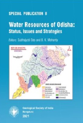
Odisha is a state rich in natural resources. Spanning 1,55, 707 sq. kms it is marked by widely varying meteorological, geomorphological, geological, hydrological, pedological and landuse characteristics which control runoff and infiltration. Its picturesque landscape presents rugged and hilly terrain, and plateaus in the west and southwest, vast undulating and flat erosional plains, narrow linear coastal belt bordering the Bay of Bengal with nine major river basins. Southwest monsoon is the principal source of water with an annual precipitation of 1500 to 900 mm, which is highly variable in space and time. Monsoon floods are common phenomenon. Droughts are chronic (occurring in 3 out of 10 years) causing water distress in different parts of the State.
SP-08: Water Resources of Odisha: Status, Issues and Strategies
SKU:
165897
Odisha is a state rich in natural resources. Spanning 1,55, 707 sq. kms it is marked by widely varying meteorological, geomorphological, geological, hydrological, pedological and landuse characteristics which control runoff and infiltration. Its picturesque landscape presents rugged and hilly terrain, and plateaus in the west and southwest, vast undulating and flat erosional plains, narrow linear coastal belt bordering the Bay of Bengal with nine major river basins. Southwest monsoon is the principal source of water with an annual precipitation of 1500 to 900 mm, which is highly variable in space and time. Monsoon floods are common phenomenon. Droughts are chronic (occurring in 3 out of 10 years) causing water distress in different parts of the State.