Showing 31–60 of 384 results

Aspects Related to River Rejuvenation in Peninsular India: A Short Overview

SKU: C-156154
100.00
The peninsular India suffers from chronic water shortage with drying up of rivers and decline of water table. The paper describes the relation between rivers and groundwater bodies. While the former recharges groundwater, the latter recharges rivers providing baseflows in lean months. The causes of river degeneration and groundwater depletion are mainly overexploitation and sand mining. MAR Technology is a means of river rejuvenation.

Assessing the Environmental Flows for the Transboundary River Ichamati

SKU: C-165853
100.00
River Ichamati, the major provider of freshwater to the Sundarbans mangrove ecosystem flowing along the India- Bangladesh border now stands disconnected from its freshwater source. This study estimates the run-off volume of the river basin through a SWAT model to consider it?s rejuvenation. A hypothetical channel-form for the disconnected part of Ichamati has been constructed using existing and regenerated cross-sections. The flow availability in the river channel under both present and restored conditions has been estimated using HEC-RAS model. The study indicates the average freshwater flow in the river at Kalanchi to be less than 1 cumec during the lean period and up to 100 cumec in monsoon. Hydrological Tennant method, Flow Duration Curve (FDC) and the holistic Building Block method (BBM) have been used to assess the environmental flows for the non-tidal part of the river. Comparable flow values of around 188 cumec during monsoon and little over 30 cumec in the lean months have been assessed after the proposed restoration using all methods. The authors advocate trans-boundary collaboration between India and Bangladesh for the revival of the decayed channel to ensure environmental flows and sustenance of the Sundarbans, a World Heritage and Ramsar site shared by the two neighbouring countries.

Assessment of Groundwater Pollution Potential of Goa using an Indexing Approach (Abhesht & Galdit Models)

SKU: C-168768
100.00
Chemical quality of surface and groundwater of an area is influenced by the climate, hydrological conditions, soil characteristics and geological formation. Irrespective of their source, all natural waters contain some chemical constituents and their quality changes progressively as they traverse over the land surface or infiltrate downward due to various hydro-geochemical processes. Anthropogenic factors also contribute substantially towards quality change of both surface water and ground water. In the present study an attempt has been made to understand the aquifer vulnerability to pollution, at the regional scale (Goa State), which takes into account the intrinsic hydraulic and hydrogeological parameters and environmental impacts. It is noticed that a variety of activities, such as agricultural, industrial and urban land uses, are carried out in the area, thus exposing the aquifers to a wide range of contaminants. Groundwater quality data of Goa state for the pre-monsoon seasons of 2014 and 2018 were obtained from CGWB (Bengaluru) and analysed statistically. A regional scale approach was developed which is known as ABHESHT (Aquifer type, Boundary conditions, Hydraulic Head representing static water level, Environmental impact, Solute concentration, Head variation (Water Table Fluctuation) during pre-monsoon and post-monsoon seasons and Transmissivity). The method has been applied to Goa State, west coast of India and compared with the observed groundwater quality parameters. It is found that the model has successfully delineated the wells which are prone to pollution. Using GALDIT model, seawater intrusion impact was also assessed. The study revealed that the groundwater of Goa State did not show any significant pollution indicator, however, seasonal variations in water quality parameters were observed. It is also found that the North Goa coast as well as the other tourist spots spread over the entire state show signs of pollution at various locations (Anjuna. Baga, Mapusa. Concona etc). This calls for immediate attention from the concerned authorities.

B.P. Radhakrishna A Commemorative Volume

SKU: 127336
500.00

The volume was brought out to commemorate the birth centenary of Dr. B.P. Radhakrishna, former Director of Department of Mines and Geology, President of the Geological Society of India and a doyen of Indian geology. It contains selected 25 landmark contributions spanning over the period from 1952 to 2008 which had significant bearing on the then existing knowledge, published in Journal of Geological Society of India and various other Journals. The papers are presented under four sections: 1. Archaean History of the Earth, 2. Geomorphological Studies, 3. Mineral Resources Development, and???? 4. Water, Environment and Ecology; each section prefaced with editorial comments by Dr. R. Srinivasan, Prof. R. Vaidyanadhan, Dr. M.S. Rao and Mr. Subhajyothi Das, respectively.

Benthic Foraminiferal Biostratigraphy of Middle to Late Jurassic Sequence, Ler Dome, Kutch

SKU: C-63316
100.00
Jurassic sediments of Ler Dome near Bhuj, Kutch, belonging to Chari Formation yielded forty-two benthic foraminiferal species from thirty-three samples. Thirteen species are reported for the first time from this region. All the species are benthic comprising calcareous hyaline and agglutinated forms. Callovian to Oxfordian age is suggested for the studied sequence. An attempt is made to mark the Callovian-Oxfordian boundary in the Ler Dome section.

Biostratigraphy and Foramiferal Paleoecology of the Early Eocene Naredi Formation, SW Kutch, India

SKU: C-63303
100.00
The Naredi Formation in southwestern Kutch overlies the last Deccan Trap deposited during the early Paleocene. The lower part of the Naredi Formation (2.8-4.2 m from base) is of early Eocene (Ypresian) age (SBZ8, E4) based on larger foraminifera and rare planktic foraminifera, whereas the upper part (9.3-11 m, including the Assilina limestone) is of late early Eocene age (SBZ11, E6). There is no age control for the basal 0-2.8 m and between 4.2-9.3 m because microfossils are rare or absent. Small benthic and rare planktic foraminifera are common in three short intervals and indicate deposition in a brackish to normal marine inner shelf environment (SBZ8, E4), brackish environment (middle of section, no age control) and inner shelf to marginal marine environment (SBZ11, E6). Two phases of marine transgressions can be identified with the maximum transgressions in each phase coincident with the lower and upper foraminiferal assemblages. A paleosol indicated by root traces and burrows (5.9 m) represents a regression and possibly sequence boundary.

Ceramic Membrane Based Plant for Purification of Ground Water for Decontamination of Arsenic and Iron

SKU: C-165859
100.00
Membrane based separation has gained importance in water purification due to certain advantages like better contamination separation efficiencies, low chemical requirement, lower footprint requirements and ease of maintenance. Ceramic membranes in particular has additional advantages like long life of operations, tolerance to harsh chemical conditions and much higher operational life compared to polymeric membranes. The advantages of ceramic membranes have been exploited in the separation of Iron and Arsenic. Ceramic membranes were developed at CSIR-Central Glass and Ceramic Research Institute and same has been applied in Arsenic and Iron Separation. Till date 250 number of plants of varying capacities ranging from 500 litre per hour to 8000 Litre per hour have been installed in eastern states of India.

Challenges in Management of Groundwater Resources of Tripura

SKU: C-165844
100.00
Tripura is occupied by the semi-consolidated sedimentary formations ranging in age from Upper Tertiary to Quaternary. It is having N-S trending alternate parallel hill ranges and valleys. Fine to medium grained, friable Tipam sandstones form the principal aquifer. Ground water exploration has shown that valleys are having very good potential aquifers. Now, ground water is extracted for drinking and irrigation purposes through thousands of ion structures like dug wells, shallow tube wells, deep tube wells and artesian wells. Tripura rely heavily on its ground water resources from deeper aquifers for drinking water supply schemes. Mean depth to water level recorded from the unconfined aquifer in the state varies from 1.03 to 7.93 m below ground level during the pre-monsoon season. Dynamic groundwater resources of Tripura estimated for the year 2016-17 by using GEC-2015 methodology show that total annual ground water recharge is 1.34 BCM, gross groundwater extraction is 0.10 BCM and stage of ground water extraction is only about 7.88% . Ground water management and extraction plans based on these figures do not consider its extraction by thousands of deep tube wells and mini deep tube wells from deeper aquifers. This paper proposes a few strategies for better and scientific management of groundwater resources in Tripura.

Changing Courses of Eastern Himalayan Rivers: Flood Hazard and Irrigation Aspects and Linking of Brahmaputra ? Ganga Rivers

SKU: C-165854
100.00
In the Quaternary period the changing landform features in the Himalayan mountainous region and piedmont zone is the reflection of interdependent responses of neotectonic effects, climate change and progressive shifts of the major rivers. The fluvial regimes and the piedmont facies also fit in a dynamic equilibrium of coalescing and migrating ?fan- in- fan? morphology with unconsolidated materials in response to oscillation of climate from cold to warm during different glacial and interglacial stages of Quaternary period as well as in recent time. Thus, the shifting of the river courses and subsequent changes in the morphological features have taken place in time and space which caused force shifting of the human settlements in recent past also.In the present-day scenario, to reduce the adverse effects of flood/ waterlogging caused by the change in river courses, the major eastern Himalayan rivers viz. Gandak, Kosi, Tista etc. are with dam and barrages. However, the canals (both main and distributaries) are passing through the alluvial fan zone where both lateral and vertical seepages are very common as observed in satellite images and ?in-situ? survey. For the reason, the canals are not fulfilling the objectives of the irrigation facilities in the command areas rather playing facilitator role towards increasing waterlogged areas along the canals.On the issue, a detailed discussion is made in this paper about the hydro-geological/ geomorphological conditions of the terrain units and anthropogenic factors for upgradation of irrigation facilities and other societal aspects through linking of the Brahmaputra ? Ganga Rivers from Bangladesh to Farakka Barrage for the benefits of the two countries in the context of the regional co-operation on water resources of five south-east Asian countries (viz. India, Bangladesh, Nepal, Bhutan and China).

Characterization of Hydrothermal Alteration at Chigargunta and Bisanatham Gold Deposits, South Kolar Greenstone Belt, Dharwar Craton, India

SKU: C-165464
100.00
The South Kolar Greenstone Belt (SKGB) which is the southern extension of the main Kolar belt hosts several gold deposits and prospects. Among them Chigargunta (CG) and Bisanatham (BN) deposits are most significant deposits. Excluding the western lode of CG which is within the mafic volcanic rocks, majority of the auriferous lodes are hosted in the felsic volcanics (Champion Gneiss) that forms the main eastern mineralization system. In BN, mineralisation is hosted mainly within mafic volcanic rocks that are in closer proximity with Bisanatham granite. Different litho-association has certainly impacted in the development of distinct alteration zones which are mineralogically different in each of these prospects. Three distinct alteration zones with specific mineral assemblages were reported in CG and, at least two zones were identified in BN. The present study focuses on alteration mineralogy and its changes within the alteration zones to characterize the hydrothermal alterations of two distinct gold hosting rocks, in terms of mineralogy and mineral chemistry, in SKGB.

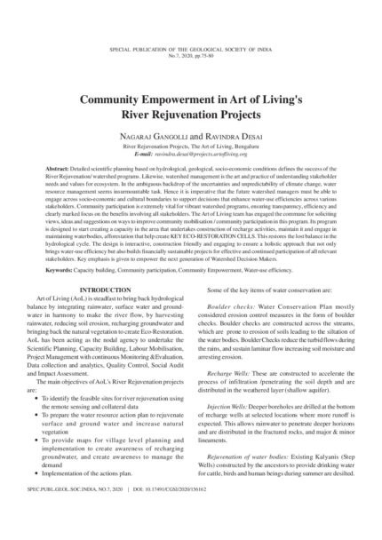
Community Empowerment in Art of Living’s River Rejuvenation Projects

SKU: C-156162
100.00
Detailed scientific planning based on hydrological, geological, socio-economic conditions defines the success of the River Rejuvenation/ watershed programs. Likewise, watershed management is the art and practice of understanding stakeholder needs and values for ecosystem. In the ambiguous backdrop of the uncertainties and unpredictability of climate change, water resource management seems insurmountable task. Hence it is imperative that the future watershed managers must be able to engage across socio-economic and cultural boundaries to support decisions that enhance water-use efficiencies across various stakeholders. Community participation is extremely vital for vibrant watershed programs, ensuring transparency, efficiency and clearly marked focus on the benefits involving all stakeholders. The Art of Living team has engaged the commune for soliciting views, ideas and suggestions on ways to improve community mobilisation / community participation in this program. Its program is designed to start creating a capacity in the area that undertakes construction of recharge activities, maintain it and engage in maintaining waterbodies, afforestation that help create KEY ECO-RESTORATION CELLS. This restores the lost balance in the hydrological cycle. The design is interactive, construction friendly and engaging to ensure a holistic approach that not only brings water-use efficiency but also builds financially sustainable projects for effective and continued participation of all relevant stakeholders. Key emphasis is given to empower the next generation of Watershed Decision Makers.

Conjunctive Use of Surface and Ground Water Resources: Selected Case Studies from Andhra Pradesh and Telangana in Peninsular India

SKU: C-95960
100.00
At present, a fragmented approach is adopted in water resource management with more focus on supply side from canal water in canal command areas. Planning for development and management of surface and groundwater resources are dealt separately. The studies taken up by in irrigation project areas in semiarid tract of Andhra Pradesh and Telangana states by Central Ground Water Board indicate that there is excessive usage of canal water resources in the upstream areas resulting in water shortage areas in the middle reaches and tail end parts of the project areas. By harnessing groundwater resources, water shortage in middle and tailend areas can be mitigated bringing these areas under irrigation. The possible approaches for implementation of conjunctive use plans are discussed in the paper.

Control of Aquifer Geometry on Groundwater Arsenic in the Gangetic Delta, India

SKU: C-165851
100.00
The highly productive delta aquifers serve as the main source of drinking and irrigation water in the Gangetic delta plains of India. However, the groundwater from these aquifers has been detected to have toxic levels of dissolved arsenic, resulting in widespread arsenic poisoning of the population living in these delta plains. The distribution of arsenic concentrations in groundwater is known to be controlled by several factors like, surface geology, aquifer architecture, sediment geochemistry, groundwater chemistry and flow dynamics, biogeochemical environment within the aquifers, groundwater ion patterns and other anthropogenic activities. A detailed study has been conducted on the control of the aquifer geometry on the distribution of groundwater arsenic in these aquifers. The study reveals that the disposition of the low permeability layers within the aquifer system imposes a strong control on the distribution of groundwater arsenic within these aquifers. The multi-layered aquifer system in the southern parts of the delta having intricate interlayering of low permeability clay layers prove to be architecturally more resistant to arsenic invasion from shallower levels than the thick aquifer sands without substantial clay layers ins the northern part of the delta where deep irrigational pumping might cause rapid inflow of shallow arsenic rich water to the deeper aquifers.

Crop Water Planning and Irrigation Efficiency in Rainfed Agriculture

SKU: C-95948
100.00
More than 70 % of irrigation needs in India are currently met from groundwater resources. Hard rock areas (HRA) in India occupy more than 65% of the geographical area where groundwater resource is in increasing demand, but fraught with poor recharge. Indian farmers pump twice the groundwater used in USA and six times that used in EU. India's green revolution was significantly supported by increased groundwater irrigation, and can be termed as 'groundwater revolution' leading to overexploitation in many regions. A fall out of overexploitation is farmers increasingly facing risk of initial and premature well failure which exacerbates the cost of groundwater. Water policies focus on the demand side of water (Million wells scheme, Subsidy for micro irrigation, conveyance pipes, energy subsidy) neglecting the supply side of water (or lack of efforts towards recharging well) affecting its sustainable use. Even considering the energy subsidy, farmers are bearing more than 50 to 75 % of cost of groundwater, treating groundwater expenditure as implicit rather than as explicit cost. The costing methodology of cultivation by DES (Directorate of Economics and Statistics)/CACP (Commission for agricultural costs and benefits) ignores the cost of groundwater by treating depreciation on all items of expenditure on irrigation well and irrigation pump (IP) set as fixed cost (for an unspecified number of years). Even the yield of the well and number of hours of operation of IP set for different crops are not properly accounted in the record type forms, where cost of cultivation is assessed on daily basis from thousands of sample farmers all over India. Thus, the DES/CACP is yet to take adequate steps in properly accounting for the cost of groundwater irrigation in the Cost Concepts (of Cost A1, A2, B1, B2, C1, C2, C3). In fact DES/CACP computes average cost of cultivation clubbing both irrigated and rainfed crop conditions. This paper suggests how DES can modify its methodology in costing of groundwater irrigation, highlighting the extent of overestimation of profits due to underestimation of cost of irrigation. By appropriately accounting for the costs of groundwater irrigation incurred by farmers, this article offers solutions for facilitating in the appropriate costing methodology for Minimum Support Prices (MSP), Statutory Minimum Price and Market Intervention Scheme for crops for the benefit of farmers.

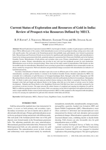
Current Status of Exploration and Resources of Gold in India: Review of Prospect-Wise Resources Defined by MECL

SKU: C-165471
100.00
Mineral Exploration Corporation Limited (MECL) has brought to finality a number of gold prospects and Resources since 1980 in different parts of the country. Gold mineralisation occurs in diverse geological settings cutting across time scale with specific peaks. One such peak is the Neoarchaean period when globally many gold deposits were formed in greenstone belts. Mesoarchaean and Proterozoic Periods too are known for significant gold mineralisation. In India, gold mineralisation is found in the Archaean greenstone/schist belts, granitoids adjacent to greenstone belt, Proterozoic Fold Belts and in the Southern Granulite Terrain. Mineralisation of both primary and secondary types occur. Primary mineralisation is both syngenetic and epigenetic in nature. Primary mineralisation may develop in any rock type but metabasalt account for most production. Mineralisation occurs in diverse structural settings. Shear zones are the major control of mineralisation. Fold closures are also favourable locales for mineralisation. Mineralised zones occurring in greenschist to amphibolite facies metamorphic terrains are always marked by retrogression. Wall rock alteration and geochemical changes associated with mineralisation are indicative of hydrothermal activity.Secondary mineralisation of lateritic and placer types also occurs in different parts of the country. In addition to primary mineralisation, secondary gold in laterites is common in the Southern Granulite Terrain. Detailed exploration by MECL has eventually led to delineation of gold Resources in Yerrappa-Gantalappa block, Ramagiri schist belt; Chigargunta and Old Bisanatham blocks in Kolar schist belt, Uti block in Hutti-Maski schist belt and Kunderkocha block in Gorumahisani ?Badampahar belt. Uti block is under active mining by opencast method whereas mining in other blocks is suspended. Dona East block in Jonnagiri schist belt and Sangli and adjacent blocks in the Gadag schist belt are in the hands of private sector for further development. Pahardia and Parasi blocks in the Singhbhum Proterozoic Fold Belt have been successfully auctioned by the government to private investors. The paper presents the salient features of completed and ongoing investigations for gold by MECL in different geological terrains in the country. With vast experience in the field of exploration with updated infrastructure under a single umbrella, besides a team of professional geoscientists, MECL is fully equipped to offer integrated multi-disciplinary services for carrying out exploration for gold and other minerals within India and abroad.

Current Status of Exploration and Resources of Hutti Gold Mines, Hutti-Maski Schist Belt, Karnataka

SKU: C-165467
100.00
The Hutti Gold Mine is located in the northern part of Hutti - Maski Schist belt. It is the only major primary gold producing center in the country. The mine has witnessed both ancient and modern mining. The gold Reserves estimated as on 1.4.2019 is 19.72 Mt @ 4.25g/t gold up to a depth of 871m or the 27th Level in the Hutti underground mine. This Reserve is classified under Proved (111) and Probable (121) categories. The exploration programme implemented in the last few years include 16,500m of surface diamond drilling and 11,000m of underground diamond drilling. 3,890 number of drill core samples and rock chip samples have been analyzed by Fire Assay. The programmes were planned judiciously and executed in two phases. For surface exploration, the Hutti Mine area was divided into 3 blocks, viz., (i) Hutti North Block, (ii) Hutti Central Block & (iii) Hutti South Block. The evaluation of exploration data has resulted in discovery of new gold reefs in the virgin and gap areas which also led to a better understanding of the geometry of existing gold-quartz-sulphide reefs besides enhancing the resource inventory.Surface diamond drilling led to the following exploration successes; (i) discovery of the existence of a new reef called Oakley?s Reef Hanging Wall (ORH) between the Oakley?s and Prospect Reefs; (ii) indicated the merging nature of Middle and Oakley?s Reefs in the north of northern dyke; (iii) indicated the presence of hanging wall/footwall branches of the existing reefs and; (vi) revealed the existence of few blind ore shoots and un-correlated lodes. Over all, the exploration has added Measured Mineral Resource (UNFC 331) of 0.59 Mt @ 4.58g/t gold which equates to 2.7 t of gold. Exploration by diamond drilling carried out in the underground mines of the Central Block of the Hutti Mine, which is the area of present mining activity, has revealed the existence of a new reef on the foot wall side of the Middle Reef which was named Middle Reef Foot wall (MRFW). A stope in this reef between 546 and 606m in Central Shaft added a high grade proved ore Reserve of 0.70 Mt @ 8.18 g/t. Inclined boreholes drilled from Zone-I (ZI), Middle (MR) and Oakleys (OR) Reefs have proved the existence of Strike Reef (SR), ZI and MR below 31st level (930m). Overall, the underground exploration programme has added Probable Mineral Reserves (122) of 0.88Mt@2.43g/t or 2.13t of gold to the inventory. On the basis of these results further detailed exploration by mine development has been planned to delineate the geometry of the Reefs and feasibility of their mining.The above exploration successes have strengthened the Exploration Team?s prognostication of the existence of inter-reef blind ore bodies as well as branching and rejoining of the Reefs both along the dip and strike extensions of the reefs. There remains more Resources to be discovered within the currently operating domains of the Hutti mines. The exploration success has enabled the management of the Company to place greater confidence in exploration as an important and indispensable part of the mining activity and appreciate the need for providing adequate budgetary support to the Exploration Department in the interest of continuously replenishing the mined Resources and Reserves. Currently, the mine has reached a kilometer depth where four major Reefs show signs of continuity. Another phase of drilling has been planned to test the down dip continuity of all the four major reefs beyond 930m which is the current deepest level that the mine has reached.

Deccan Continental Flood Basalt Eruption Terminated Indian Dinosaurs before the Cretaceous-Paleogene Boundary

SKU: C-63310
100.00
Late Cretaceous-Early Paleogene sediments associated with Deccan Continental Flood Basalt (DCFB) sequences of central and western India record the timing of the introduction and extinction of Late Cretaceous dinosaurs in India based on magnetostratigraphy and magnetic susceptibility stratigraphy. Current taxonomy indicates that only two genera of titanosaurs (e.g., Isisaurus and Jainosaurus), at least four species of large-bodied abelisauridae theropods (e.g., Rajasaurus narmadensis, Rahiolisaurus gujaratensis, Indosuchus matleyi and Indosaurus raptorius) and a small-bodied theropod Laevisuchus inhabited India during the Maastrichtian. Their stratigraphic and geographic distribution suggests that these dinosaurs were dominated by titanosauriforme and abelisauridae that first appeared before the advent of Deccan volcanism in the magnetochron C30n and were well established with the acme of breeding and nesting during C30n to maastrichtian C29r. Their decline in diversity and abundance coincides with initiation of DCFB eruptions when most of the early taxa were terminated and only a few titanosauriforme sauropods survived becoming extinct at about 350 kyr before the Cretaceous-Paleogene boundary (KPB). Dinosaur extinction in India is thus directly tied to Deccan volcanism with no evidence of an asteroid impact.

Delineation of Aquifers through Ground Water Exploration in Goa State

SKU: C-168767
100.00
CGWB (1997) Master Plan for Goa state. Central Ground Water Board, Faridabad. CGWB (2009-2011) Basic Data reports of Piezometers. Hydrology Project-II in North and South Goa Districts, Goa State, Central Ground Water Board, 2011. CGWB (2013) Report on Ground Water Exploration in Goa State. Technical Report of Central Ground Water Board, Faridabad, 2013. CGWB (2015) State Report of Goa (Hydrochemistry), Central Ground Water Board, Faridabad, 2015. DPSE (2009) Statistical Handbook of Goa. Directorate of Planning, Statistics and Evaluation, Panaji, Goa, 2009. DOWR (2012) Ground Water in Goa. Department of Water Resources, Govt. of Goa, 2012. DPSE (2011) Goa at a glance. Directorate of Planning, Statistics and Evaluation, Panaji, Goa. 2011. Gopalakrishnan, Gukul, A.R., Srinivasan (1985) Stratigraphy and Structure of Goa, Earth Resources for Goa?s Development (publication), Geol. Surv. India, 1985. Gukul, A. R. (1985) Structure and Tectonic of Goa, Earth Resources for Goa?s Development (publication), Geol. Surv. India, 1985. Subburaj, A. and Davithuraj, J. (2019) State Report of Goa (Hydrogeology), Central Ground Water Board, Bangalore, 2019. Subramanian, P.R., Sahoo, K.B. Bhatnagar, S.K (1997) Results of Ground water exploration in hard rock areas of Vidarbha Region, Maharastra, Proceedings of National seminar on Hydrogeology of Precambrian Terrains and Hard Rock Areas, Karnatak University, Dharwad.

Delineation of Phreatic Basaltic Aquifers in the Upper Nira River Basin, India and Evaluating the Efficacy of Methodologies Used for Estimating their Groundwater Potential ? A Case Study

SKU: C-168773
100.00
The Upper Nira River Basin (378.83 km2), in the Upland Deccan Traps is witnessing a transition from being a traditional rain fed, non-command entity to a predominantly surface irrigation command area. Understanding and accurately computing the change in groundwater storage is a vital component in groundwater estimation. The lava flows constitute 3 aquifers in the basin, UNR-1 , UNR-2 and UNR-3. The efficacy of the methodologies used for estimating the groundwater potential of the Upper Nira River Basin is evaluated. Groundwater assessment based on the GEC 2015 methodology has been undertaken to estimate a net available recharge of 4419 Ham in the aquifers and gross groundwater draft of 461.49 ham. The basin has been categorised as Safe due to low stage of exploitation (~11%). The people residing in the basin however face severe scarcity of groundwater during the summer season annually in spite of receiving copious rainfall (about 1500 mm) during the monsoon. The likely reasons for such a paradox are high surface runoff, low permeability, low storativity of aquifers, high base flow plus draft, etc. According to the new and simple aquifer-based methodology proposed in this paper the quantity of recharge (Q) for Aquifer UNR-1, Aquifer UNR-2 and Aquifer UNR-3 are 1146.70, 1691.02 and 16.97 km3 respectively. Thus, there is a difference in recharge to the tune of 1411 hams i.e. about 24% less recharge compared to the results obtained by the aquifer based methodology as per GEC (2015) guidelines. When the new recharge values are used in the GEC 2015 methodology a scenario close to reality emerges in the Nira River basin which proves the efficacy of the new methodology.

Delineation of Possible Areas of Petroleum Exploration using ENVISAT ASAR and ERS Data in Mahanadi Offshore Basin, India and the Potential and Prospect of 85? E Ridge

SKU: C-95909
100.00
With gradual depletion of oil reserves in the continental part of the earth and to cope with the increasing demands of present life there is no other option but to look towards the offshore oil potentials. Remote sensing and GIS technology appear to be the most suitable, reliable and economic technique for a reconnaissance survey, particularly in the offshore region which is otherwise inaccessible. In the present study ENVISAT ASAR and ERS image data have been used to delineate potential oil bearing zones for further detailed exploration in the Mahanadi offshore basin. At first, the oil seepages are identified from the images and are plotted on a georeferenced map in GIS environment. Then the oil seepages are differentiated from the pollution slicks coming out of moving ships or tankers and the biogenic slicks formed due to algal material. After discarding the aforesaid noise slicks the natural oil seepages are analysed on the basis of shape, size and repetitiveness with time. Finally the identified natural seepages have been correlated with major tectonic features and structural elements such as basement faults and Cretaceous faults present underneath in the ocean floor which may provide avenues for the oil to reach the sea bed. A fairly good relationship is seen between the oil slicks and the faults. During this study some oil seepages in the deep offshore region are found to be associated with 85? E Ridge System situated underneath. Earlier workers suggested the 85? E Ridge to be showing positive magnetic anomaly of single polarity and negative free air gravity anomaly and the region may represent a continental sliver. The present study highlights the possibility that the 85? E Ridge is a potential zone for further exploration for petroleum.