
Publications


Freshwater Sources of Kerala ? Hydrometeorological Scenarios, Environmental Threats and Management Strategies
SKU:
C-165441
Kerala, the southwestern coastal state of India receives an annual average rainfall of about 3000 mm. However, providing uninterrupted freshwater supply to the community round the year is a major challenge to the water managers in the state because of several factors including high population density, increased human interventions in the river catchments, environmental effects due to climate change, etc. It has now become more and more evident that the nature and contributions of rainfall, especially its pattern, have been changing drastically over the years, aggravating the incidences of floods and landslides in the wet season and water scarcity in the summer months. Although such incidences were minimal in the pre-liberalization period (1956-1990), their recurrence and impacts are getting aggravated in the post-liberalization period - a period that witnessed severe environmental degradation due to rapid urbanization and economic development in the region. As per the records of the gauging stations, the number of no-flow/low flow days are found to be increasing even in the lowland reaches of the major rivers in the state. The adverse impact of unabated groundwater ion/pumping is on the rise in many parts of the state, as the activity is being carried out without due regard to the safe yield and natural recharge capability of the aquifer systems. The rapidly changing water scenario of the state in the pre-and post-liberalization periods needs a thorough investigation, especially in regard to the structure and functions of its near surface terrestrial environment called the Critical Zone. The Critical Zone, the zone extending from tree top to the aquifer bottom, of the state is under immense stress due to many of the aforesaid reasons. The stress in the Critical Zone will have a direct effect on the quality, quantity and availability of the freshwater resources in the surface and subsurface reservoirs, which needs to be addressed adequately for laying down strategies for the conservation and management of the freshwater sources.

Geochemistry of Gold-Hosting Granitoids from Jonnagiri Greenstone Belt, Eastern Dharwar Craton: Implications on Petrogenesis and Gold Mineralization
SKU:
C-165463
Jonnagiri gold deposit is a lone example of granitoid-hosted orogenic gold deposit in India. Gold mineralization is concentrated within silicified alteration zones along shear zones within the Pagadarayi granodiorite. Geochemical characteristics of unaltered Pagadarayi granodiorite show that, (i) these are granodiorite-tonalite suite of rocks, (ii) contain lower and variable amount of silica (63-72%), (iii) high Fe(Tot), (iv) varying alkali concentrations, (v) large variations in LILE and LREE, particularly K2O, Sr, Ba, Th, La, Ce. Further, in the Harker-type variation diagrams these granitoids show (i) decreasing agpaitic index (molecular Al2O3/Na2O + K2O) with increasing SiO2, (ii) characteristically low Sr/Sr* values, and (iii) no significant correlation of (Ce/Y)N. Hence, these rocks were possibly derived from partial melting of a mafic source with contribution from the LILE-enriched felsic crust. Harker-type variation diagrams plotted against SiO2 show decreasing trend for Fe2O3, MgO, CaO and TiO2 while Na2O increases with increasing silica content. These features are consistent with the initial stage fractional crystallization of plagioclase, pyroxene ? magnetite, followed by hornblende and biotite at a later stage. The higher Na2O, CaO, Sr and lower Cr, Ni, concentrations are similar to the continental arc magmas and therefore, these are grouped under the I-type granitoids which is in agreement with their crystallization from more oxidized melts in relation to major granitoid-hosted gold deposits elsewhere in the world.
Geological Mapping of Foundation Floor for Nuclear Building of Rajasthan Atomic Power Project, Rawatbhata, India
SKU:
C-95903
Foundation floor mapping is essential for important structures to provide permanent data set for geological interpretations. At Rawatbhata, Rajasthan, two units of 700 MW each Pressurized Heavy Water Reactor (PHWR) type Nuclear Reactors are being constructed adjacent to existing Rajasthan Atomic Power Project (RAPP) units 1 to 6. In order to evaluate the design basis foundation parameters engineering geological mapping on 1:100 scale was carried out for Nuclear Building-7 structures. 1 m x 1 m grids were prepared for mapping of the floors and walls. Based on the field observations and evidences, it was found that the floor area consists of fine to medium grained, compact quartzitic sandstones. The floor region was seen to contain certain iron stained and weathered zone. No evidence of faulting was observed on the surface of the floor areas. However, there were some isolated patches of soft, weathered/altered rock and small fractures in the rocks. Geotechnical assessment of the foundations of RB-7, RAB-7 and ECCS north and south pits was done on the basis of detailed engineering geological mapping, geological drill holes logging data, rock mass permeability values, geophysical profiling and laboratory test results. This permanent foundation record will assist in making better interpretation of post-construction foundation instrumentation data.
Geological Setup for Gold Prospects and Deposits in India
SKU:
C-165460
Gold metallogeny having distinct temporal distribution has a direct relationship with changes in the global tectonic processes. In India too gold metallogeny is episodic from Mesoarchaean to Neoproterozoic peaking in the Neoarchaean and Paleoproterozoic periods. Indian Phanerozoic also show discrete feeble mineralisation which is not of any economic interest. The most productive gold deposits are restricted to Neoarchaean granite-greenstone terranes of Dharwar Craton. Gold deposits/ prospects occur in the eastern as well as western blocks of the Craton, but most productive deposits are in the Eastern Dharwar Craton. Current gold production in the country is mainly from three Neoarchaean deposits in the Hutti-Maski greenstone belt. A small size Mesoarchaean deposit has been located in Singhbhum Craton also. The gold deposits are generally lode type or vein/reef type restricted to shear zones. Secondary shear zones or splays are the loci for mineralisation of commercial interest. Deformed and metamorphosed host rocks exhibit extensive wall rock alteration along the mineralised zones. The deposits are of epigenetic Au or Au-W types with sulphides.During Palaeo and Mesoproterozoic times, gold mineralization occurred in the Fold Belts/Supracrustal belts of the Singhbhum, Bastar and Bundelkhand cratons, namely Aravalli belt, Mahakoshal belt, Singhbhum belt, Kotri belt, Sonakhan belt, Sakoli and Raigarh belts. The mineralization is of Au-Cu and Cu-Au types with basemetals (Cu & Zn) as a dominant component as compared to the gold-only type during Archaean period. Despite the existence of a number of drilled gold and copper-gold resources spread over the three cratons mentioned above, only one mine is being operated at Lawa in Singhbhum Fold Belt which produces a small quantity of about 13kg of gold per annum (as reported in IBM?s Mineral Year Book).VMS type Cu-Au-U metallogenesis reported from Singhbhum Shear Zone, contributing gold as a by-product of copper mining. VMS type Cu-Au prospects abound in Rajasthan. Neoproterozoic (830-850 Ma) Khetri copper deposits exhibit IOCG type Cu-Au mineralisation where gold is recovered as a by-product. Porphyry style Cu-Au-Mo mineralisation is associated in Malanjkhand granite producing gold as a by-product. Mesoproterozoic Cu-Au-Zn prospects are common in the Sakoli Fold Belt. Gold is also found within the Chhotanagpur Gneissic terrain.Palaeoplacer deposits in Quartz Pebble Conglomerate (QPC) are present in Neoarchaean Iron Ore Group (IOG) of Singhbhum Craton and in Bababudan Group of Dharwar craton. Paleoplacer U-Au occurrences are found at the Neoarchaean-Paleoproterozoic boundary exposed at the basal part of Dhanjori basin in Singhbhum Fold Belt. U-Au bearing palaeoplacers, sampled so far, have shown anomalous to interesting gold valuesGold is also reported from the Tertiary laterite covering parts of the Southern Granulite Terrain and Neoarchean greenstone belts in Goa State. Present day placer gold is being recovered locally from eluvial, alluvial and colluvial zones in different parts of the country.
Geology of Bihar and Jharkhand
SKU:
55860
This book provides an exhaustive account of the geology of the two States that occupy a crucial position in the Indian Peninsular Shield. The book is authored by an experienced geologist with first-hand knowledge of the geology of the composite Bihar State.
The book attempts to weave the fascinating story of the geological evolution of a vital segment of the Indian Shield, which is also richly endowed with diverse mineral resources.
Geology of Himachal Pradesh
SKU:
166665
The Himalaya, stretching from the Nanga Parbat (8126 m) in the west to the Namche Barwa (7756 m) in the east, forms an arcuate mountain belt and a rampart for the Indian subcontinent along its northern margin (Fig. 1.1). It comprises the earth's largest mountain range with its varied geotectonic zones (Fig. 1.2). From time immemorial the Himalaya has been the source of poetic and spiritual inspiration. It has, ever since the advent of man, sustained several civilizations that flourished on the plain that bordered along its southern margin with its perennial rivers, lush green forests along its slopes and the fertile soil of the land that lay at its feet.
Geology of Tamil Nadu and Pondicherry
SKU:
55854
Tamil Nadu occupies an important segment of the southern granulite terrain of the Peninsular Shield, where extensive khondalites, charnockites and migmatitic rocks are traced. The eastern coastal tract is characterized by Phanerozoic sedimentary cover.
The volume includes chapters on early history of geological work in the areas and geo-environmental studies.
Geomicrobiology of Arsenic (As) Contaminated Groundwater of West Bengal Reveals Microbial Role in Sediment Bound Arsenic Mobilization
SKU:
C-165856
Geogenic arsenic (As) in groundwater of the Bengal basin has led to ?the worst mass poisoning in human history? with >170 million people exposed to toxic levels of As. Understanding the mechanism(s) underlying As release into groundwater from host minerals is a critical issue for developing any sustainable drinking water supply strategy. Release of As results from complex interplay between hydro-geo-microbiological processes. The present study aims at analyze microbial community structure, dynamics, and metabolic role using groundwater sampled from two As hotspots of West Bengal (Barasat and Swarupnagar). Metagenomic DNA based 16S rRNA gene (V4 region targeted) sequencing showed dominance of Gammaproteobacteria and Alphaproteobacteria. Incubation of groundwater microbiome with aquifer sediment showed a marked shift in community composition with an abundance of Rhizobium, Paenibacillus, Acinetobacter, and Staphylococcus reportedly known for anaerobic hydrocarbon utilization, iron reduction, As biotransformation, and fermentation abilities. Change in physicochemical properties indicated microbe-mediated geochemical transformations. Thus, the study highlighted the role of groundwater microbial community members in facilitating the mobilization of sediment-bound As.
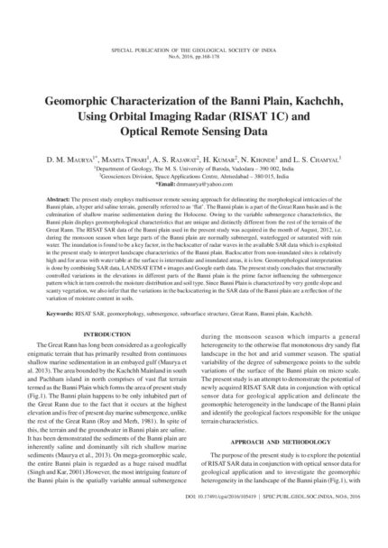
Geomorphic Characterization of the Banni Plain, Kachchh, Using Orbital Imaging Radar (RISAT 1C) and Optical Remote Sensing Data
SKU:
C-105419
The present study employs multisensor remote sensing approach for delineating the morphological intricacies of the Banni plain, a hyper arid saline terrain, generally referred to as 'flat'. The Banni plain is a part of the Great Rann basin and is the culmination of shallow marine sedimentation during the Holocene. Owing to the variable submergence characteristics, the Banni plain displays geomorphological characteristics that are unique and distinctly different from the rest of the terrain of the Great Rann. The RISAT SAR data of the Banni plain used in the present study was acquired in the month of August, 2012, i.e. during the monsoon season when large parts of the Banni plain are normally submerged, waterlogged or saturated with rain water. The inundation is found to be a key factor, in the backscatter of radar waves in the available SAR data which is exploited in the present study to interpret landscape characteristics of the Banni plain. Backscatter from non-inundated sites is relatively high and for areas with water table at the surface is intermediate and inundated areas, it is low. Geomorphological interpretation is done by combining SAR data, LANDSAT ETM + images and Google earth data. The present study concludes that structurally controlled variations in the elevations in different parts of the Banni plain is the prime factor influencing the submergence pattern which in turn controls the moisture distribution and soil type. Since Banni Plain is characterized by very gentle slope and scanty vegetation, we also infer that the variations in the backscattering in the SAR data of the Banni plain are a reflection of the variation of moisture content in soils.
Geomorphology of North-Western India (Marusthali to Narmada Valley Ending Up with Vindhyan Scarplands) with Special Reference to Surface Waters
SKU:
C-62870
Resource potential in space and time is dependent upon the hydro-geomorphic dynamics that include topography, precipitation and lithology. Regional geo-climatic conditions control the distribution and availability of water resources and their development requires a scientific evaluation of potential and terrain appropriate structures. In this context, the northwestern region of the Indian subcontinent has diverse geomorphologic characteristics ensuring a wide disparity in the distribution of surface water resource. The rivers are seasonal and the flow is dependent on the rainfall which varies from less than 100 mm in the arid land to more than 1000 mm in the eastern hilly areas. Based on the variations in these parameters, the area is divided into five hydro-geomorphic units 1) Dunal Plains of Thar, 2) Semi-arid to Arid Alluvial Plains, 3) The Eastern Hill Ranges, 4) The Plateau and Pediments (buried/exposed) and 5) Coastal Plains. The major issues in harnessing the surface water include seepage/evaporation losses in the plains and excessive runoff due to steep slopes and hard rock lithology in the hilly areas. Unavailability of water in the downstream due to damming of rivers, changing land use and obliteration of drains in the catchment of ponds are some human induced major issues in this region. Ample groundwater resource and advent of tube wells led to neglect of the existing water harvesting structures as well as surface water bodies, but now, the ground water is fast depleting. There is good surface water potential at least in parts of the region, but its rejuvenation needs impetus. The water availability and security can be improved adopting a basin perspective provided the resource is managed in a holistic and integrated manner at this level.
Geomorphology of the North Eastern Region of India with Special Reference to Surface Water Resources
SKU:
C-62879
The North Eastern Region represents a unique geophysical and ecological setup vis-a-vis the eastern Himalayas dominated by extremely dynamic earth processes, intensely potent monsoon rainfall regime, hyperactive seismicity and a fabulously rich biological and cultural diversity. The region is richly endowed with a vast water resource potential accounting for about one-third of the country's total water wealth although its utilization has so far been grossly limited. The Brahmaputra, a transboundary river originating in Tibet (China) and one of the world's largest and most complex alluvial river systems, drains a major part of the region. The Barak is another dominant river system flowing in the southern part of the region that eventually flows across the border to Bangladesh. The floodplains of these rivers are dotted with a large number of wetlands (locally known as Beels) that have considerable ecological, hydrological as well as economic significance. However, most of these wetlands are in degraded or derelict condition due to accelerated sedimentation, eutrophication, encroachment and various other anthropogenic factors. The study discusses different aspects of fluvial geomorphology in relation to the geologic and geotectonic frameworks of the region. An integrated basin planning and management approach seems to be the most appropriate paradigm for utilizing the vast water wealth of the region and mitigating its associated hazards. The geologic/geomorphic ideas and techniques are increasingly known to have great relevance in the management and conservation of rivers and other water bodies like wetlands, especially in the context of North East India.
Geotechnical Problems Associated with Infrastructure Development Activity in the Himalayas
SKU:
C-95901
There are several issues associated with infrastructure development in the Himalayas; they fall under diverse categories like administrative, socio-economic, environmental, and techno-geological. The techno-geological issues which are of immediate concern to us are generally referred to as 'Geological Uncertainties' in engineering parlance. They are, generally, due to insufficient budget allocation for quality geological surveys, and unavailability of manpower appropriately trained in geological engineering field. Many hydropower projects have been and are to be constructed in the area to harness the hydropower potential of the rivers and their tributaries. These major infrastructure projects lead to development of ancillary industries, communication routes, transportation, tourism and other development works in the area. Serious consequences may result from inadequate or incompetent geotechnical investigations. This paper outlines the geotechnical problems and related issues associated with these developmental projects and to collate the basic information inputs for identifying the problems in future and addressing their solutions.

Glimpses of Surface Water Scenario in Some Eastern and North Eastern States in India
SKU:
C-165846
The Ganga and the Brahmaputra river system constitute the major river network draining a vast alluvial terrain in eastern and north-eastern sector of India. The Ganga?Brahmaputra?Meghna river system is carrying 1375 BCM water annually. However, distribution of water in these rivers are uneven, bulk of which are available only during four monsoon months of a year. In the remaining eight months the water flow is reduced to its one?sixth amount. A number of Major and Medium Command Area Projects have been implemented. But there are possibilities to harness many more for optimum utilization of available water resources in this part of the country. A number of critical issues like Command Area Management, Resettlement and Rehabilitation of displaced Communities, Flood Management, Drought Management specially in Chotonagpur Plateau areas, Desilting of existing canals, Quality deterioration of river waters await solution.In order to have optimal and rational utilization of available water resources in this part of the country, a number of recommendations have been made.
Gold in Dharwar Craton: Current Genetic Understanding
SKU:
C-165461
Neoarchean orogenic gold-only deposits in the Dharwar Craton occur in wide variety of host rocks such as metamorphosed mafic/felsic greenstones, banded iron formations, volcaniclastic rocks and granitoids. The characteristic features of these deposits are (i) greenschist to mid-amphibolite facies conditions of metamorphism; (ii) alteration and mineralization in shear-induced higher order structural splays, and (iii) low salinity aqueous-gaseous (H2O+CO2?CH4+NaCl) fluids that precipitated gold in a narrow P-T window of 0.7-2.5 kbar and 215-320 ?C. There are also reports of uncharacteristic high salinity granitic fluids from surface samples of Ramagiri. Further, propositions favoring mantle- and granite-derived fluids have been made from the calculated fluid ?18O-?D and ?13C values of quartz and calcites. Major, trace element and B-isotope composition of tourmaline, on the other hand, suggest metamorphic ore fluids, with minor magmatic involvement. Similarly, composition of scheelite, pyrite and arsenopyrite from the ore zones suggest operation of fault-valves resulting in fluid phase separation, that acted as the dominant process of gold precipitation, besides fluid-rock sulfidation reactions. Available ages of greenstone metamorphism, granitic activity and mineralization in the Hutti Belt are almost identical, making a geochronology-based resolution of the existing debate on the metamorphic vs. magmatic fluid source impossible. On the other hand, consistently observed low salinity nature of the ore fluid points to its unlikely extraction from granites, emplaced at mid to upper crust. On the contrary, fluids released by metamorphism of pyritic carbonaceous shales at the greenschist-amphibolite facies boundary are characteristically of low salinity and have elevated concentrations of S, Au and As, necessary to form orogenic gold deposits.
Gold Resources of India: Immense Scope for Development of New Gold Mines
SKU:
C-165466
The geological potential of India to host gold resources is globally well known but exploration to realise the potential is grossly inadequate. This paper is an attempt to take stock of India?s Resource-Base (Reserves + Resources) of gold and it?s potential to support development of new gold mines in the near future. More than 700 ancient workings and about 200 gold prospects are spread over 12 States in the country. The Mineral Inventory by Indian Bureau of Mines indicates a resource of 654.74 tonnes of gold metal as on 1.4.2015. As per the compilation made by the author the Resource Base in the country, as at the end of March 2019, is 670 tonnes plus a Prognosticated Resource of 198 tonnes of gold metal. The annual mine production of gold is in the range of 2-3 tonnes in the last decade. Only one major gold mine located at Hutti in Raichur District of Karnataka and two of its satellite mines are in continuous operation. India is a major consumer/importer of gold to sustain its huge jewellery industry. The drain on foreign exchange reserve is to the tune of 40 billion US$ annually to import about 800t of gold. Almost all the gold occurrences, prospects and deposits in India are sited in greenstone-belts, Mesoproterozoic fold-belts and, to a minor extent, in Mesoproterozoic Sedimentary Basins. An attempt has been made in this review to present State-wise, geological belt-wise and Prospect-wise Resources and Reserves. Apart from the few prospects which have been adequately investigated, hundreds of prospects and gold occurrences spread over the country await detailed exploration involving investment of thousands of crores of rupees for defining and/or augmenting the resources and converting the known resources into mineable reserves through feasibility studies. At Rs.4000 per gram, many among the 200 known gold prospects in the country could be developed as small operations under MSME model with distinct possibility of several of them eventually developing into largescale operations like at KGF and Hutti.The recent reforms in the Policy and amendments to the Act are inadequate in so far as mineral exploration is concerned specifically precious metals. Fast-tracked implementation of the Act & Rules has been the need since decades to enable investors to freely and effectively operationalise their planned programmes of exploration and mining. Gold Exploration and Mining deserves to be dealt with under a separate National Authority-Precious Metals Authority of India (PMAI)), on par with Coal, Steel & Hydrocarbon because of huge domestic demand for gold of the order of 800 to 1000 tonnes per annum and the important role gold plays in the economy of India. PMAI would serve to facilitate and focus private investment, including FDI and, for fast tracking the currently stagnating exploration and development of new gold mines in the country.
Ground Water Based Irrigation in the State of Odisha: The Way Forward
SKU:
C-164716
Ground water, as a source of irrigation in the state of Odisha has been studied. As on 31sta March 2013, the state possesses net annual utilizable groundwater resource of 16.69 BCM. Net groundwater draft is 5.02 BCM, yielding a stage of groundwater development of 30% in the state, which is too less in comparison to the national average of 62%. The irrigation draft stands at 4.14 bcm, constituting 82.5% of the net groundwater withdrawn. Estimations reveal that groundwater, as a source of irrigation in the state accounts for only 13.0%, in contrast to more than 50% in major parts of India. The hard rock (?90% of the state area) and the coastal regions share ?54% (2.25 bcm) and 46% (1.89 bcm) of the net groundwater draft for irrigation in the state. The stage of groundwater development in the hard rock region is low at 23.9% and in the coastal tract it is moderate at 46.5%. In the phreatic aquifer, an additional of 11.20 bcm of resource (hard rock region, 8.87 bcm; coastal region, 2.33 bcm) is still available for future irrigation. Additional dug wells and shallow tube wells in the phreatic zone can be constructed to harness the resource. Water conservation measures like nala bunds, check dams etc on the small and minor drainages and also creation of ponds and tanks in the hard rock region will help in generating more groundwater resource for exploitation. Besides, deep tube wells at suitable locations can yield ample water for irrigation. However, in the hard rock region, owing to limited groundwater potential of aquifers, groundwater irrigation is more suited for low water intensive crops particularly in the rabi seasons.
Ground Water Conservation and Artificial Recharge in Madhya Pradesh: A Pragmatic Approach
Conference Papers, SP-12: Water Resources of Western and Central Regions of India: Status, Issues and Strategies
SKU:
C-168762
The increasing pace of ground water extraction in agricultural, industrial and domestic sectors during the past four decades has led to problems of continuously declining ground water levels and deterioration of groundwater quality in many areas of Madhya Pradesh. This has threatened the sustainability of many dug wells and tube wells. Depending heavily on agriculture-based economy, the State requires assured irrigation for sustainable agricultural productivity. Groundwater is the major source of irrigation, and also the sole source of drinking water. But the development of ground water is constrained due to heterogeneity of the formations, non-uniformity in degree and nature of the weathered and fractured zones of the aquifers. It is observed that there is heavy surface run-off in many areas during the monsoon period often resulting in floods, yet these very same areas face crisis of water during the summer. This flood? drought syndrome is basically resultant of improper management of available water resources. As ground water is an annually replenishable but limited resource, augmentation of the recharge to ground water is the only option left for ensuring its sustainability.The present study is aimed at identifying the areas in Madhya Pradesh suitable for artificial recharge to arrest the depletion of ground water resources on the one hand and create additional resources to cater to the domestic, agricultural and industrial needs in the State.